A new exhibition on Gund Hall’s Experiments Wall uniquely approaches a provocative topic: fatal encounters between civilians and police across the country. Multimedia in its presentation and cross-disciplinary in its approach, “Bang Bang Bang: Housing Policy and the Geography of Fatal Police Encounters” applies design and mapping tools and pedagogy to reveal the spatial implications of this phenomenon.
On exhibit through October 18, “Bang Bang Bang” was orchestrated by the Harvard Graduate School of Design’s African American Student Union (AASU) and the Joint Center for Housing Studies (JCHS). Project coordinators Marcus Mello (MArch/MUP ’18) and Lindsay Woodson (MDes/MUP ’16) collaborated with summer fellow Héctor Tarrido Picart (MLA/MAUD ’15), as well as the GSD’s Ann Forsyth, Chris Herbert, and James Stockard (LF ’78), to generate and synthesize their research.
Mello and Woodson hope that the exhibition helps suggest how design can enter and influence discussions of justice reform and race.
“We hope that viewers can reflect on linkages between racial conditions and the physicality of the built environment on the national and city level,” Mello says. “Seeing not only where fatal encounters have occurred, but also how intensely segregated certain cities are, was powerful in itself.”
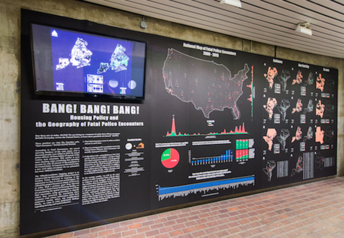
Focusing on data from 2000 to 2015, “Bang Bang Bang” presents the team’s research and data in an assemblage of charts and graphs. The exhibition’s largest graphic is a map of the United States that displays a latitudinal aggregate of fatal encounters between civilians and police that occurred in the 2000–2015 time frame, accompanied by a bar graph presenting an aggregation of the numbers by year. The 100 counties in the U.S. with the most fatal police encounters are also broken out into a separate bar graph.
The largest panel of the exhibition presents a series of maps and data sets on fatal police encounters in Baltimore, New York City, and St. Louis, each sorted into three time frames: 2000–2004, 2005–2009, and 2010–2015. Names and ages of each fatality are listed beneath the maps.
The team concluded that most fatal police encounters occur in urban corridors and not in rural areas; that there is a strong positive correlation across the U.S. between fatal encounters and racially segregated counties; and that at the urban scale, fatal police encounters occur most frequently around racially segregated neighborhoods.
The team will continue similar research on other U.S. cities this semester. With this exhibition, Woodson expresses hope that the visualization stands as a provocation for design pedagogy and professions.
“We are hoping to provoke deep, reflective thinking about a designer’s role in engaging such discussions and capacity to define such conditions,” Woodson says. “Regardless of a viewer’s agreement or disagreement with our work, importantly, we wanted them to feel something.”
“Placing an exhibit on this topic in the GSD can send a message that designers can play an active role in these issues,” Mello adds.