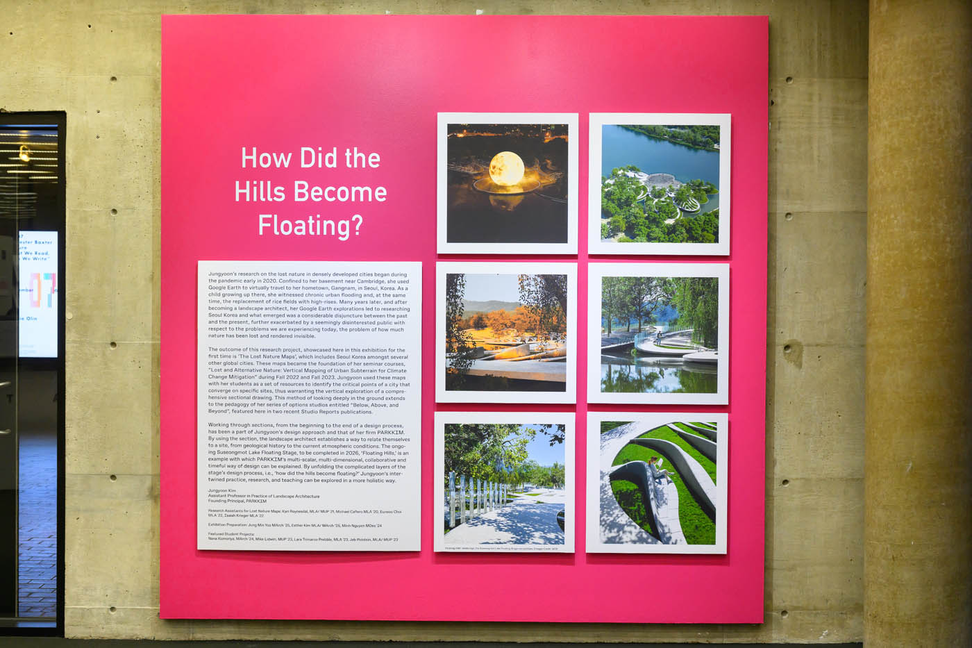
How Did the Hills Become Floating?

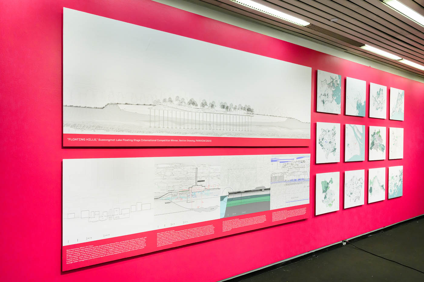
"FLOATING HILLS," Suseongmot Lake Floating Stage International Competition Winner, Section Drawing, PARKKIM (2024)
Jungyoon’s research on the lost nature in densely developed cities began during the pandemic early in 2020. Confined to her basement near Cambridge, she used Google Earth to virtually travel to her hometown, Gangnam, in Seoul, Korea. As a child growing up there, she witnessed chronic urban flooding and, at the same time, the replacement of rice fields with high-rises. Many years later, and after becoming a landscape architect, her Google Earth explorations led to researching Seoul Korea and what emerged was a considerable disjuncture between the past and the present, further exacerbated by a seemingly disinterested public with respect to the problems we are experiencing today, the problem of how much nature has been lost and rendered invisible.
The outcome of this research project, showcased here in this exhibition for the first time is ‘The Lost Nature Maps’, which includes Seoul Korea amongst several other global cities. These maps became the foundation of her seminar courses, “Lost and Alternative Nature: Vertical Mapping of Urban Subterrain for Climate Change Mitigation” during Fall 2022 and Fall 2023. Jungyoon used these maps with her students as a set of resources to identify the critical points of a city that converge on specific sites, thus warranting the vertical exploration of a comprehensive sectional drawing. This method of looking deeply in the ground extends to the pedagogy of her series of options studios entitled “Below, Above, and Beyond”, featured here in two recent Studio Reports publications.
Working through sections, from the beginning to the end of a design process, has been a part of Jungyoon’s design approach and that of her firm PARKKIM. By using the section, the landscape architect establishes a way to relate themselves to a site, from geological history to the current atmospheric conditions. The ongoing Suseongmot Lake Floating Stage, to be completed in 2026, ‘Floating Hills,’ is an example with which PARKKIM’s multi-scalar, multi-dimensional, collaborative and timeful way of design can be explained. By unfolding the complicated layers of the stage’s design process, i.e., ‘how did the hills become floating?’ Jungyoon’s intertwined practice, research, and teaching can be explored in a more holistic way.
Credits:
Jungyoon Kim
Assistant Professor in Practice of Landscape Architecture
Founding Principal, PARKKIM
Research Assistants for Lost Nature Maps: Kari Roynesdal, MLA/ MUP ’21, Michael Cafiero MLA ’20, Eunsoo Choi MLA ’22, Isaiah Krieger MLA ’22
Exhibition Preparation: Jung Min Yoo MArch ’25, Esther Kim MLA/ MArch ’25, Minh Nguyen MDes ’24
Featured Student Projects: Nana Komoriya, MArch ’24, Mike Lidwin, MUP ’23, Lara Trimarco Prebble, MLA ’23, Jeb Polstein, MLA/ MUP ’23

