Public Sediment for Alameda Creek
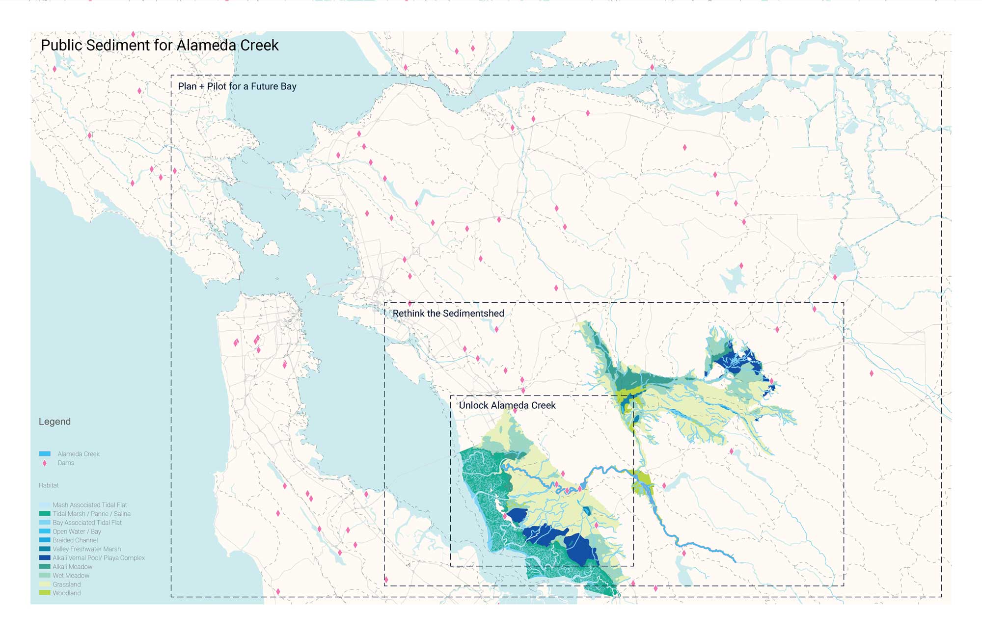
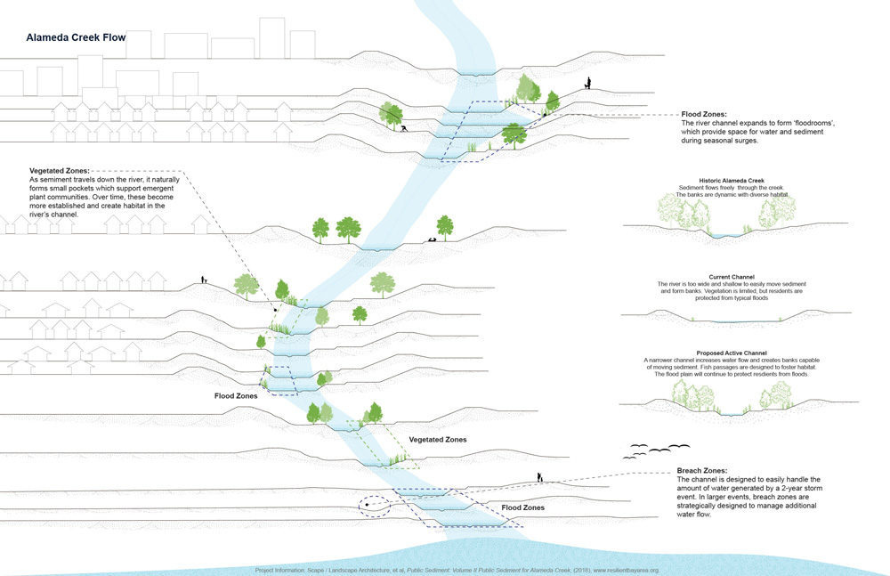
Resilient by Design was the Bay Area’s year-long collaborative design challenge for resilience to sea level rise, severe storms, flooding, and earthquakes. The challenge was led by design firms but included input from public officials, local, national, and international experts, as well as local residents. The initiative proposed nine different projects, including Public Sediment: Unlock Alameda Creek, which proposes that sea level rise adaptation must happen upstream and uses the creek to deploy sediment to downstream baylands to protect tidal ecosystems. The project is essentially a linear system including marshes and mudflats that moves more sediment than the existing creek down the watershed. Alameda Creek is the largest tributary to San Francisco Bay, and is arranged around a creek constituency from the headwaters to the downstream baylands, including living and constructed infrastructural elements, like upstream dams and downstream sills. The project balances differing requirements by the Army Corps of Engineers, including considerations on vegetation in an area that has been used as a channel for water and areas for overflow, as well as allowing tidal fluctuation into existing salt ponds. The project’s three key elements are sediment, people, and fish, as the proposal connects migratory fish to their historic spawning grounds and creates community spaces around the creek. These spaces, including mudrooms, seasonal crossings, and terrace trails, bring residents closer to the water. The project will ultimately require stewardship for longevity and an investment by the community after the initial construction.
References
Holmes, Rob, Tim Maly, and Brett Milligan. “The Pulse, the Sink and the Shortfall.” Ground Up Journal 04 (2015).
Links
Resilient Bay Area, Unlock Alameda Creek.
SCAPE Studio, Public Sediment for Alameda Creek.