An Island in Flux: Envisioning a more resilient Nantucket
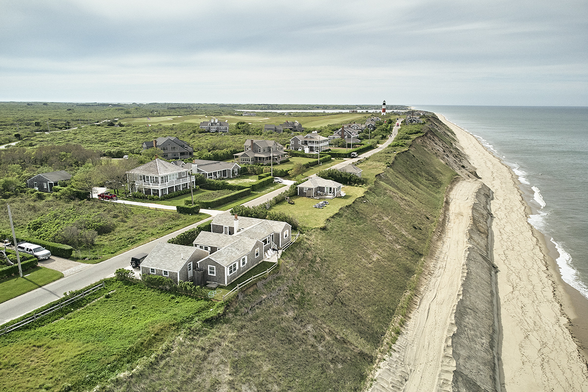
Nantucket offers a vivid illustration of the principle of flux, the idea that everything is in a constant state of becoming. There is a powerfully optimistic sense to this ancient Greek concept: on one hand, steady change begets stability—think of a river or an organism, which is never quite the same from one moment to the next, yet it resolutely maintains its identity—and on the other, “becoming” suggests possibility, improvement, and innovation. Lately, we have become accustomed to viewing change with trepidation: climate change, especially, offers fearsome potential for catastrophe. Warmer temperatures and rising oceans will alter Nantucket, possibly inundating its beaches, its historic town center, and other low-lying areas across the island.
A recent survey of Nantucketers revealed that over 70 percent are “very worried” about climate change. However, the Envision Resilience Nantucket Challenge organized by ReMain Nantucket calls for a sense of confidence in the face of change. It “seeks to inspire the community to imagine a future that is adaptive in the face of sea level rise.” Over the last year, ReMain Nantucket has brought together island residents, scientists, business leaders, artists, and preservationists to advise graduate students and faculty from five different US design programs, including a group from the Harvard GSD led by Professor Chris Reed, as they considered the possibilities for long-term change on Nantucket.
Nantucket took shape through the unhurried dynamism of earth’s geological transformations. Twenty-five thousand years ago, the slowly advancing Laurentide ice sheet pushed huge piles of soil and gravel southward, forming irregular glacial moraines south of Cape Cod. The ice retreated, sea levels rose, and erosion beat down the low hills to form Martha’s Vineyard, Nantucket, and the Elizabeth Islands. The earliest settlers on Nantucket walked there from the mainland before the Atlantic gradually surged up around it. Some 10,000 years before Greek philosopher Heracleitus first wrote about the concept of flux, the Wampanoag people benefited from change on the island, taking advantage of its seasonal abundance of food. They fished on the windswept shore during the summer and retreated to more protected inland areas to hunt and harvest cranberries in the winter.

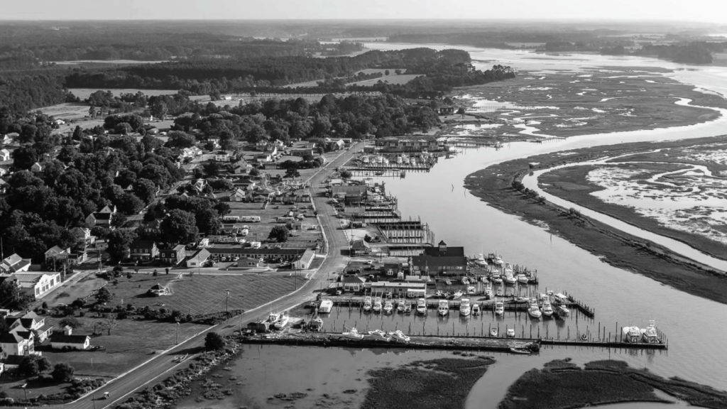
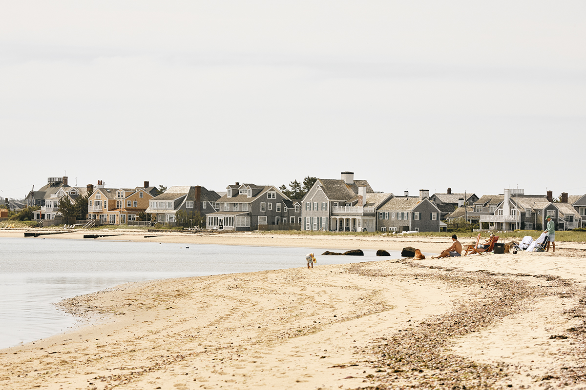
European settlers on Nantucket from the 1640s on carried with them a very different understanding of change and land tenure, fixing property boundaries and building more permanent settlements. Although their fortified harbors, sturdy wooden buildings, and well-established infrastructure offered a degree of stability over the last four centuries, natural flows of water, wind, and time have continually enforced the inevitability of change. The island’s first harbor silted up in the late 18th century, requiring the main town to move two miles to a new harbor. A hundred years of whaling enriched the island, but a devastating whale oil fire, another silted harbor, and the distant civil war sent Nantucket into decline. The whalers and other settlers drifted away, although a diminishing fishing industry persisted. Beginning in the 1950s, tourism shifted the island’s economy again, bringing wealthy property owners and visitors and as well as a diverse population of seasonal and full-time service workers.

Global climate change will affect this current version of Nantucket, but the crucial question is whether sea level rise, altered ocean currents, and unfamiliar weather patterns will bring catastrophe or a new becoming for the island. Reed’s spring semester Landscape Architecture studio, “Away. . . Offshore. . . Adrift. . . Shifting Landscapes, Unstable Futures,” delved deeply into this question. Although it carefully addressed the Envision Resilience Nantucket Challenge, the studio considered the consequences and possibilities of change even more broadly, both in the context of the island, and with a view toward other maritime localities that must also respond to climate change. Reed and his 10 students examined the natural and human drivers of change, in order to understand their entanglements and their mutually reinforcing influences on the island.
In the initial research portion of the studio, “Migrations,” Reed proposed that “climate change and human practices are already having significant impacts on the island, eroding bluffs and collapsing houses, flooding critical infrastructures and streets around downtown and the port, impacting the quality of the natural environment and its ability to sustain habitat and ecological life.” To understand these circumstances more fully, students undertook research in five different areas—earth, water flows, ecologies, people, and land tenure—“within a broader frame of glacial, hydrologic, ecological, and social change over longer periods of time.”
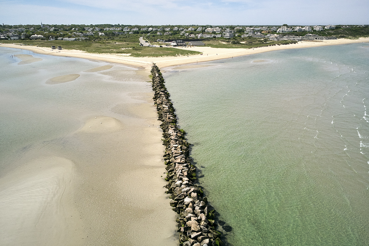
Part of the goal of this first phase, Reed explains, was to avoid merely responding to the crisis at hand—to “the set of now conditions”—so they could account for “the bigger forces that are in play.” Using software to model the flows of water, for example, the students were able to understand present-day mechanisms of erosion and sedimentation within the much longer processes of constant change that have shaped the island from the beginning. They could then speculate on how these flows might continue to alter Nantucket’s shorelines. In particular, Reed points out, students could envision how human efforts, such as the creation of groins, jetties, and artificial islands, or the dredging of harbors, have contributed to natural geological alterations of the island. Modeling provided crucial insights into the problems these devices have caused, but also showed how they might be used creatively to help mitigate or even capitalize on long-term effects of climate change.
Research into social changes on the island yielded other insights, recalling, for example, the “light touch” of Indigenous modes of seasonal land use, in contrast to European settlers’ more fixed approaches to settlement on the island. The students investigating people and land tenure on Nantucket also uncovered the diverse stories of an island disconnected in crucial ways from mainland culture—of the Wampanoag settlers—“People of the First Light,” of enslaved people who had escaped their oppressors and found refuge on the island, of generations of prominent Black landowners and whalers who prospered there, and more recently of a large number of people from all over the world who provide seasonal labor.
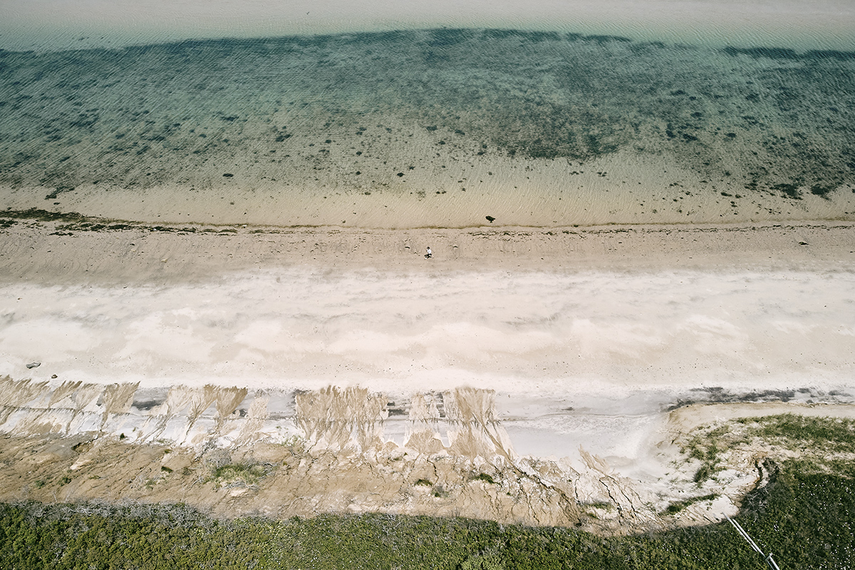
In phase two of the studio, “Shifting Grounds,” students continued their research with what Reed calls “performative speculations.” These exercises “introduce a physical design component,” Reed explains, and get the students “to deal with materials, physical things and physical forms within a constantly changing and dynamic environment.” Digital simulations in this phase of the studio helped students look at “the physical and the temporal, and the mutual effects between them, so that they are designing with these forces in mind.” They investigated ways, for example, that installation of fences or piles on a vulnerable shoreline might help control beach erosion and encourage dune deposition, or how chains, nets, and other small structures anchored in shallow tidal areas would channel flows of water and sediment to make shore areas more productive for sea life, or how houses might be anchored against the attrition of coastal bluffs.
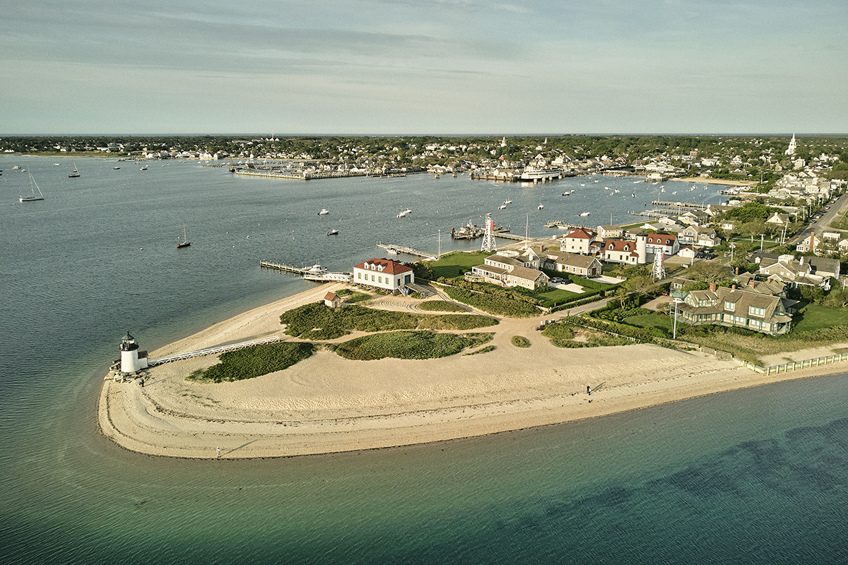
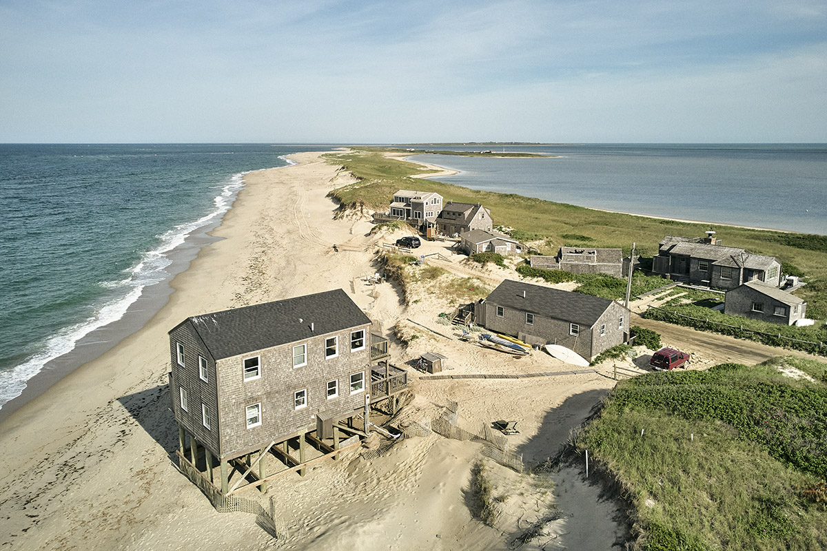
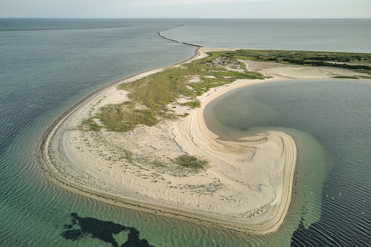
During the final phase of the studio, “Provisional (Re-)occupations,” the students carried this research into designs for specific sites on the island. In focusing on the vulnerable areas identified by Envision Nantucket—Brant Point, downtown, and Washington street—students developed extensive long-term proposals that could take advantage of sea level rise and shifts in tidal currents to improve habitats and accommodate evolving public interests. But Reed explains that he wanted these proposals “to go beyond the brief that Envision had given us, which was very much focused on the inner harbor and the downtown,” in order to address more comprehensive climatic and social issues that affect the whole island. So students also proposed long-term protections for and reconfiguration of other important places on the island—the collapsing bluffs on the North Shore and the barrier beach of Coatue peninsula.
The benefit of going beyond the brief in their proposals, Reed argues, was that “because we stepped so far back to look at some of the formational processes in a bigger geography [the students] were able to say ‘we can actually address a whole bunch of potentially bigger problems by acting out here, than by acting locally.’” The resulting designs proposed sometimes subtle, sometimes dramatic adjustments to the island’s shorelines that would allow Nantucket to evolve productively while sustaining the fundamental identities of the island and its communities.
Although climate change is a developing crisis—a widespread disaster of our own making—this studio extended from a sense of optimism about change. From the outset, “Away. . . Offshore. . . Adrift. . . Shifting Landscapes, Unstable Futures” accepted that Nantucket is in flux—as it always has been. Climate change became the inspiration for long-term designs to build more plentiful habitats and fisheries, more protective shorelines, and more resilient and flexible communities. In the face of malevolent change, of potential catastrophe, the studio instead envisioned powerful new ways of becoming for Nantucket.