Quito and the Elasticity of the Spanish American Block
Using the city of Quito as a laboratory, this studio examines the urban legacy, current decline, and future opportunities of the Spanish-American colonial grid. It will specifically focus on the typological tropes and morphological elasticity of the Spanish American block as a point of departure to imagine new urban development in the context of a historically charged site.
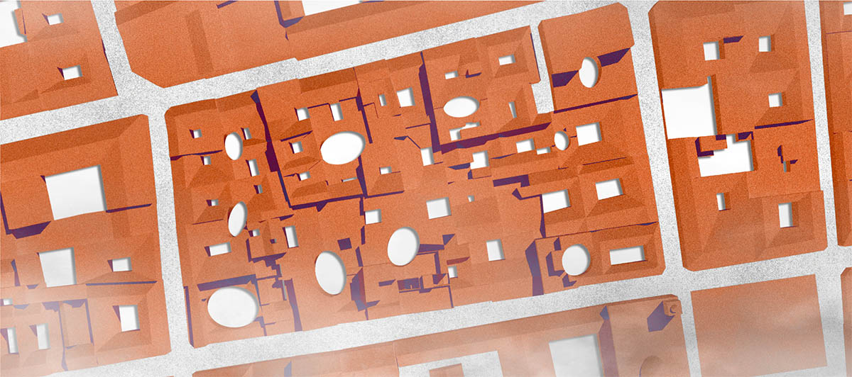
From the mid-fifteenth century until the consolidation of the Latin American Republics, the Spanish crown founded 911 cities throughout the Americas. Guided by urban planning principles that later became part of the “Law of Indies,” these cities were planned and built as physical representations of the Spanish empire. The main public square, the distribution of the three powers around it (government, municipality, and church), and the relentlessness of the 100 varas by 100 varas (.80 meter) urban grid were the main elements of the most expansive city-making project in the history of the Americas. Key to the Spanish American urban grid was the fractal design of its city block, which involved a subdivision method where blocks originally dimensioned for a single monastery were subdivided in multiples of four—through the introduction of the small patio and the zaguan—in order to accommodate more domestic uses. This fractal approach is what made the Spanish-American urban grid a resilient mixed-use urban district.
While many of the original Spanish American city centers have become heritage sites of global importance, most of them are empty, in residential use, and in economic decline. In cities like Bogota, Lima, and Quito, the historic core is bustling during the day with businesses that cater to tourism and government offices, yet quiet once the workday is over. Most buildings house commerce on the ground floor while upper floors are primarily used as storage spaces or unused. Lack of investment in the upgrading of basic infrastructure and poor connections to more burgeoning city districts outside of the historic core has resulted in the gradual erosion of a 24-hour city in most, if not all, the historic districts in Latin America. This urban disinvestment is most noticeable in the city of Quito, where extreme topography paired with ill-conceived twentieth-century mobility infrastructures have drastically isolated the city center from the more economically active districts to the north and south.
This studio will investigate the historic evolution and current state of the Spanish American colonial city. The research will focus on Quito, but open a comparative perspective by examining 10 of the most important Spanish American grids deployed in the Americas (Cartagena, Cuenca, Lima, Mexico City, Antigua, Tucuman, among others). This research will be followed by travel to Quito, funded by the David Rockefeller Center for Latin American Studies. Furthermore, the course will explore the fractal complexity of the original block model as a device that can help generate new urban types that accommodate contemporary urban uses—uses that can mediate between contemporary development requirements and preservation pressures. The strategies will aim to provide Quito’s historic core with a new lease on life by creating a framework for mixed-use residential spaces that could bring residents back to the city center.
Projects
-
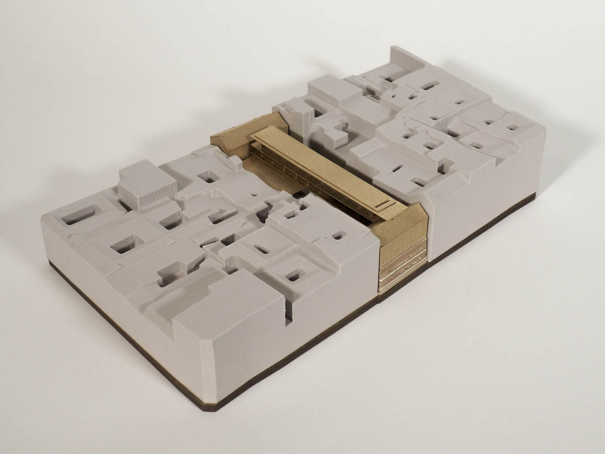
Excavated Extrusions
Spring 2018
-
In Between Pitched Roof and Modernist Slab
Spring 2018