Master in Real Estate Practicum
The Practicum involves a two-month supervised placement of an MRE student within a United States or international private for-profit, private not-for-profit, or public real estate organization to participate in ongoing real estate projects that advance beneficial spatial, social, and environmental outcomes. Practicum placements are arranged by the MRE program and matched to the interests of each student and Practicum partner. Students will attend a Practicum Prep seminar during fall and spring terms, meet remotely from time to time during the summer with fellow students and faculty, and finally return to the GSD for a several-day concluding session during which they will engage in discussions and presentations.
This course is required for and limited to students in the GSD Master of Real Estate program.
Practicum dates: Monday, June 2 through Friday, August 29.
Leadership, Entrepreneurship
This course explores how to conceive, build, and lead successful real estate organizations. Students learn how to create an initial strategy, craft and implement a business plan, manage an organizational culture, and compete in a world in which the only constant is change. The mediating role of ethical standards is emphasized throughout the course, helping students identify specific challenges in real estate settings and strategies to guard against ethical failures.
This module course takes place Tuesday, May 13th through Friday, May 23rd. Enrollment is limited to students in the GSD MRE program.
Negotiation
This course combines evolving academic theory with simulations to teach the concepts and practice of effective multi-party negotiation among developers, owners, governments, community groups, tenants, lenders, and investors.
This module course takes place Tuesday, May 13th through Friday, May 23rd. Enrollment is limited to students in the GSD MRE program.
Master in Real Estate Practicum
The Practicum involves a two-month supervised placement of an MRE student within a United States or international private for-profit, private not-for-profit, or public real estate organization to participate in ongoing real estate projects that advance beneficial spatial, social, and environmental outcomes. Practicum placements are arranged by the MRE program and matched to the interests of each student and Practicum partner. Students will attend a Practicum Prep seminar during fall and spring terms, meet remotely from time to time during the summer with fellow students and faculty, and finally return to the GSD for a several-day concluding session during which they will engage in discussions and presentations.
This course is required for and limited to students in the GSD Master of Real Estate program.
Practicum dates: Monday, June 1 through Friday, August 28, 2026.
Leadership, Entrepreneurship
This course explores how to conceive, build, and lead successful real estate organizations. Students learn how to create an initial strategy, craft and implement a business plan, manage an organizational culture, and compete in a world in which the only constant is change. The mediating role of ethical standards is emphasized throughout the course, helping students identify specific challenges in real estate settings and strategies to guard against ethical failures.
This module course takes place Monday, May 18th through Friday, May 29th, 2026. Class does not meet on Memorial Day, Monday, May 25th. Enrollment is limited to students in the GSD MRE program.
Negotiation
This course combines evolving academic theory with simulations to teach the concepts and practice of effective multi-party negotiation among developers, owners, governments, community groups, tenants, lenders, and investors.
This module course takes place Monday, May 18th through Friday, May 29th, 2026. Class does not meet on Memorial Day, Monday, May 25th. Enrollment is limited to students in the GSD MRE program.
Urban Intermedia
Urban Intermedia
“Urban Intermedia” argues that the complexity of contemporary urban societies and environments makes communication and collaboration across professional boundaries and academic disciplines essential. Each discipline produces its own forms of knowledge, but also has “blind spots” that can only be approached through other disciplinary frameworks. Those blind spots are the focus of the research and exhibition. Four city-based research projects in Berlin, Boston, Istanbul, and Mumbai form the core of the project and exhibition.
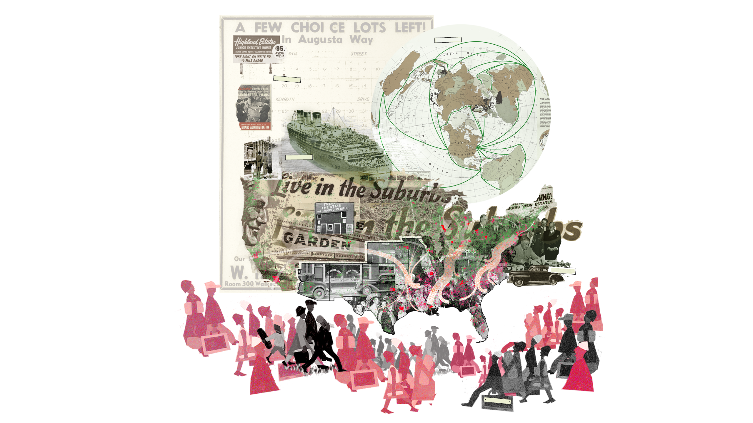
The theme for the Boston portal is “Race and Space”: cautionary tales about systemic racism. In the United States, urban projects emerge from collisions of competing interests and struggles over power and space, but also from racialized policies and exclusionary practices. In the urbanization of Boston, racism has been a persistent, yet insufficiently addressed phenomenon dominated by two recurring themes: pervasive racism toward communities not considered “white” (native Americans, black Americans, and most post-Puritan immigrants at various points in time), and tireless resistance to racism through community organizing and civil disobedience.
Between 1950 and 1980, federally funded highway and urban renewal projects swept through U.S. cities. National programs that promised to connect and rebuild crumbling urban cores instead systematically dismantled them, in the process disproportionately harming immigrants and people of color. These programs were designed primarily to respond to urban neglect following two post–World War II migratory movements. First, “white flight” saw white Americans moving to the suburbs, motivated by the promise of a better life and fueled by federally insured mortgage lending that chiefly benefited white veterans and steered them away from “red-lined” inner-city neighborhoods, which were predominantly black. Second, there was a mid–20th-century peak in the Great Migration of black Americans moving north and west to escape the Jim Crow laws of the Deep South and pursue economic opportunity. Many settled in segregated inner-city neighborhoods and, in Boston, were concentrated in a wedge-shaped area of the city where many black Americans and immigrants still live, experiencing dramatic disparities in wealth, educational attainment, and life expectancy as well as below-average access to jobs, open space, and public transportation.
While disparities caused by systemic racism are unambiguous in Boston, open discussion of the subject has only recently become a part of mainstream public discourse. The research presented here is intended to contribute to that discourse. It spans three eras of city-making and focuses on three physical infrastructures that define the spatial and political dimensions of the “wedge.”
“South Bay: Land-Making and Shifting Demographics” explores the interrelationship of migration and mobility in the shared histories of land-making, industrialization, mobilization, and immigration at South Bay, connecting industrial growth to immigrant influx and the early roots of Boston’s racist past. At the beginning of the 19th century, Boston embarked on a land-making campaign to support growing industries and meet housing demands. By the mid-20th century, the land area of the Shawmut Peninsula (home to the greater Boston metropolis) had increased 400 percent. In South Bay, the transformation was an incremental layering of shipping, rail, and highway infrastructures, and industry and housing fluctuated between serving two groups: working class immigrants and minorities, and predominantly white middle-class “Yankees” and “Yuppies.” This research exposes Boston’s manifestly limited progress in combating the effects of systemic racism over 150 years of housing development around South Bay.
“Southwest Corridor Park: Infrastructure and Community Power” explores the planned and unplanned impacts of racially insensitive public policies, community resistance to those policies, and remedial actions taken in the making and mending of Southwest Corridor Park. Federal highway expansion projects of the mid-20th century ripped through minority and immigrant communities across the country. In Boston, an Inner Belt connector was planned as the last remaining section of Interstate Highway 95, which would connect Florida to Maine (and, locally, Boston to Cambridge and Somerville). The project was ultimately halted by multi-city community action, but not before six miles of the neighborhood were demolished. Today, the Park is a reminder that celebrated urban infrastructures—including community gardens, playgrounds, bike paths, and subway lines—do not automatically improve the well-being of communities, especially if those communities are not true partners in their making.
“Columbia Road: Big Plans and Social Tensions” tracks nature and technology as oscillating drivers for urban growth. In the late 19th century, Frederick Law Olmsted championed an era of U.S. city planning aimed at mitigating the “harmful effects” of industrialization through park infrastructure. Boston’s most iconic public infrastructure, the Emerald Necklace, was designed to improve public health, support social cohesion, and drive market investment. But the Columbia Road section of the plan was never finished. With the city’s renewed commitment to completing Olmsted’s Necklace, the question today is, “Will Boston seize the opportunity presented by the Columbia Road project to empower communities, promote equity, and combat systemic racism through truly collaborative action?”
For more information about the Harvard Mellon Urban Initiative, please visit mellonurbanism.harvard.edu .
View the Animated Narratives .
NoBe Nexo
NoBe Nexo
Lisa Hollywood (MAUD ’17), Chris Merritt (MLA I ’17), Patricia Alvarez (MDes REBE ’18) and Lindsay Woodson (MDes RR/MUP ’17)
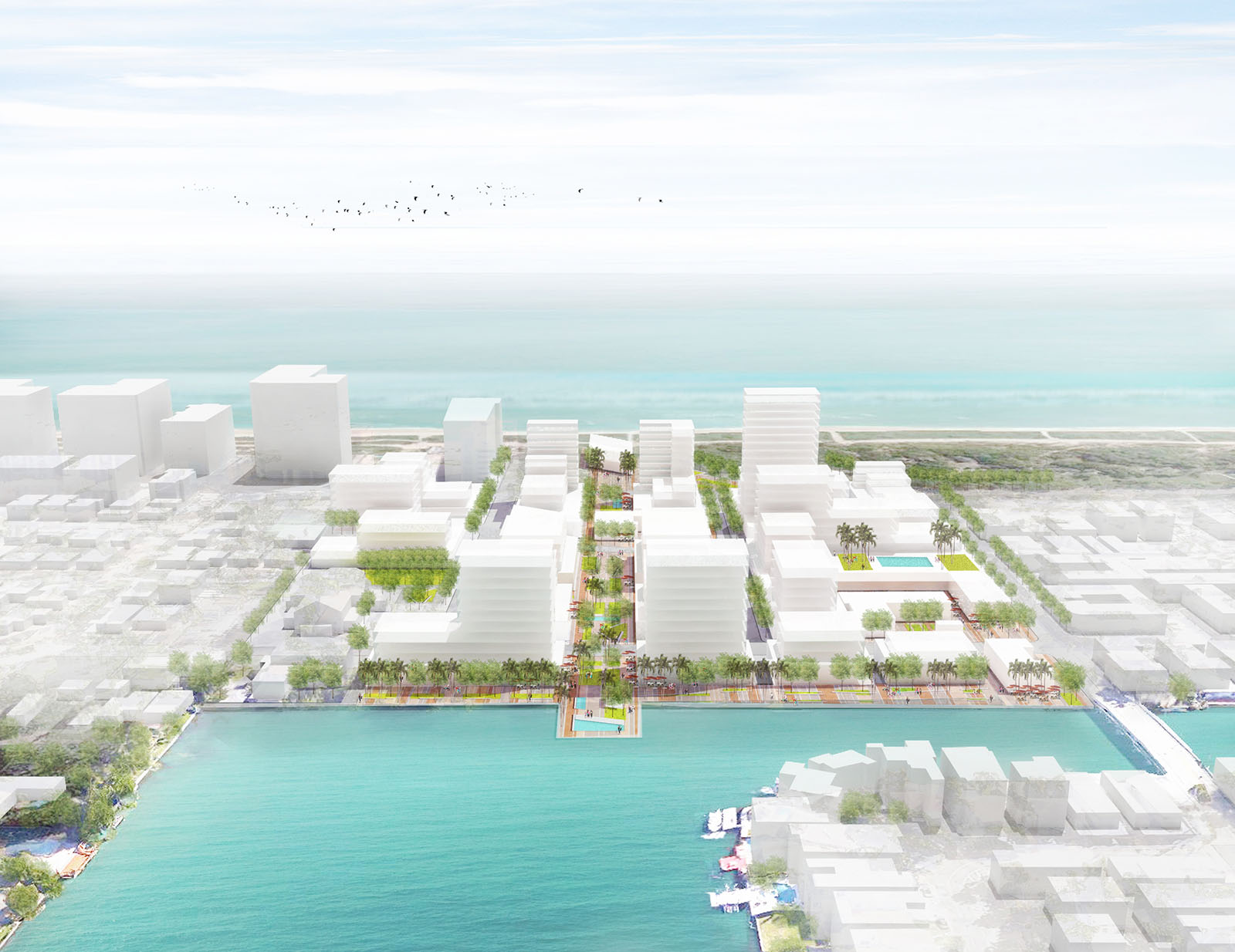
NOBE NEXO is a redevelopment project in North Miami Beach, Florida, integrating a mix of uses into a cultural and culinary hub that through a performative density strategy provides a model of resilience to climate change and gentrification. The project implements immediate mitigation and prevention measures for pressing environmental risks as well as delivering assets relevant to the current residents and local character of the neighborhood.
Located at the boundary between the affordable neighborhood of North Beach and the upscale neighborhood of Surfside to the north, development pressure is acute at this location. Nobe Nexo creates a nexus between the disparate neighborhoods and protects the residents of North Beach from wholesale displacement.
The current North Beach community is economically disadvantaged compared to its neighbors, and the population is largely Hispanic. This project also aims to ameliorate the food insecurity of the neighborhood and frames the development as a culinary destination for all income levels.
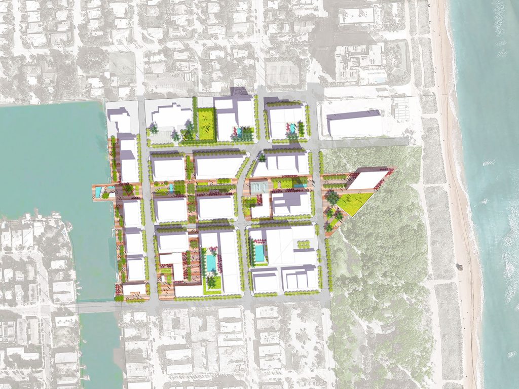
The 18-acre site includes 1.5 million square feet of retail, hospitality, institutional and residential uses, offering an array of products and units to balance the requirements for affordability and luxury within 3 phases over a 15 year investment horizon. The land assembly is facilitated by a clustering of publicly-owned land at the site, with 58% of the parcels owned by either of the city (West Lots) or institutions (elementary school, senior housing, and church).
In order to afford the resiliency measures required for the area, on top of the subsidies applicable to the development, the Adaptation Action Area seeks to involve third party capital through innovative financing alternatives. The level of investment calls for an enhanced density or “Performative Density” within a private-public partnership structure to ensure the feasibility of public benefits. The massing responds to the existing context with height along the bay and Collins Avenue, and steps down toward single-family housing to the south. Neighborhood features are preserved within the redevelopment, with the preservation of specific historic buildings and the continuation of existing institutional uses.
The main artery of the development, Nexo Paseo, is an open space promenade connecting the bay and the ocean, and is the focal point of food-related programming and community vitality. It performs as the food hub, job center, economic driver, and stormwater management system that functions as the foundation of the development.
Design Trust for Public Space, New York, NY
Design Trust for Public Space, New York, NY
During the summer of 2012, Melissa Alexander (MAUD 2013) served as a Program Associate at The Design Trust for Public Space in New York City. The Design Trust is a nonprofit organization that is dedicated to improving the design, utility, and understanding of New York City’s parks, plazas, streets, and public buildings. Their project-based model brings together neighborhoods, public agencies, and design professionals to identify innovative opportunities within the city.
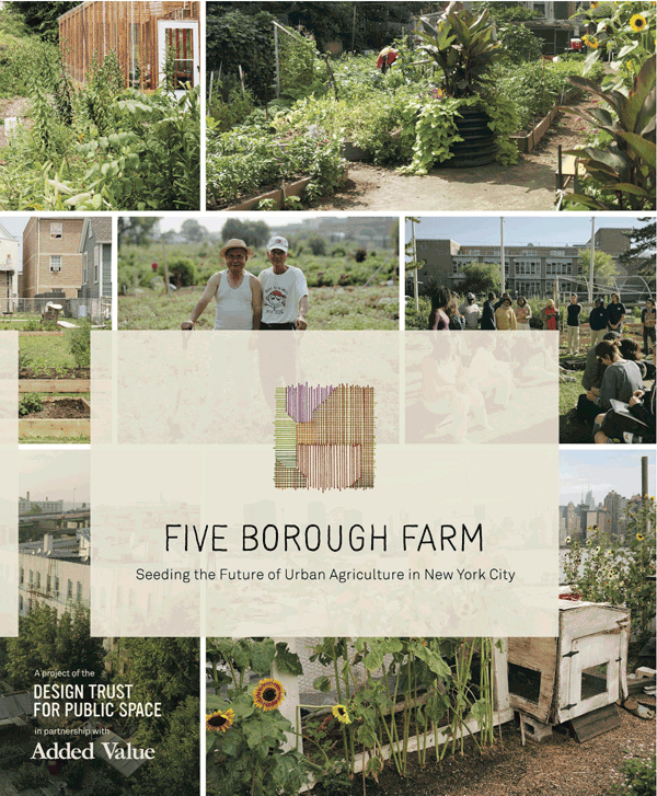
While at the Design Trust, Melissa worked on two major projects: Five Borough Farm, which looks at New York City’s urban agriculture movement through the lens of community development, and Making Midtown, a report on NYC’s garment district which offers important policy recommendations to increase the viability of urban manufacturing.
Melissa’s experiece was funded by the Harvard Club of New York.
Summer 2012