Democratizing Miami’s Healthcare Economy: Anchoring Growth in Overtown
Democratizing Miami’s Healthcare Economy: Anchoring Growth in Overtown
Syed Ali (MUP ’19) and Muniba Ahmad (MUP ’19)
As Miami reaches for an ever more ambitious role as a global city, its growing economy engenders yawning disparities in individual and community wealth. At the epicenter of this struggle is Overtown, the historic heart of Black Miami, whose downtown location places it at risk of gentrification, displacement, and erasure.
Miami’s growth manifests not just through the emergence of new industry, but also through the maturation of those industries which have long anchored the economy. The Health District, just across the highway interchange from Overtown, is home to the second largest concentration of medical and medical research facilities in the country. While capital does not currently flow between the neighboring areas, the cluster of public and nonprofit institutions can fulfill its responsibilities to its surrounding communities by becoming an active participant in economic empowerment. Leveraging healthcare for community wealth building can make Miami a more inclusive model for the future of the American city.
This report first describes current economic conditions in Overtown, exploring the need for inclusive economic development. Next, it introduces an alternative model for inclusive economic development: anchor-based cooperative development. With this approach, collectively owned businesses can create long term community wealth. After examining precedents from other American cities, the report concludes by proposing how such a strategy can be applied in Overtown, connecting the strengths of and opportunities for anchor institutions, government, nonprofit partners, and philanthropic conveners.
Infrastructure Plus
Infrastructure Plus

Chuanying (Channing) Zheng (MLA AP ’19) and Maoran Sun (MAUD/MDes Technology ’20)
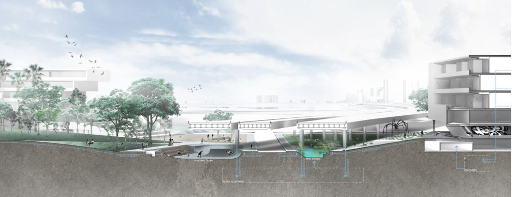
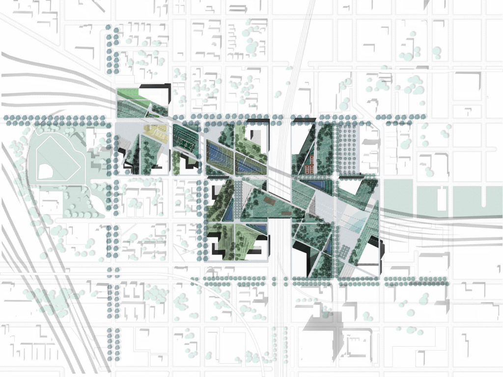
This design is reidentifying the meaning of infrastructure and envisions a new version of infrastructure towards the urban environment. This design expresses that infrastructure can not only increase the connection for city mobility but also for social living as well. Infrastructure Plus is a design that breaks segregation, creates connections and combines with different programs that together form a more sociable, sustainable and livable community.
The site is located at Overtown, Miami. Overtown is divided by highway I-95 and I-395’s intersection to three parts. These internal segregation leads to public life’s fragmentation and community’s lack of identity. To bring the community together, a new type of infrastructure is introduced into Overtown. This “Infrastructure Plus” design system combines housing, recreation, retail and other public programs to create public pathways and spaces that are connecting different area as well as providing public center for the whole community. Formally, this new infrastructure breaks the segregation that made by the autonomy of highway intersection. The continuity of the shape implies the existing infrastructure as well as creating the new networks that connect to different neighborhood areas. Different entrances at local school, youth center, sports field, supermarket and as well as a beautiful water landscape inside highway intersection that make this infrastructure not only accessible to the whole community but also bind different programs together. This new infrastructure provides public space for all kinds of using functions, as well as reinforcing and increasing the public life and living quality for local people. In Conclusion, with the idea of this Infrastructure Plus, more programs and public space will be brought to the area, this new infrastructure can show our vision for a denser, more sociable and well-connected Overtown.
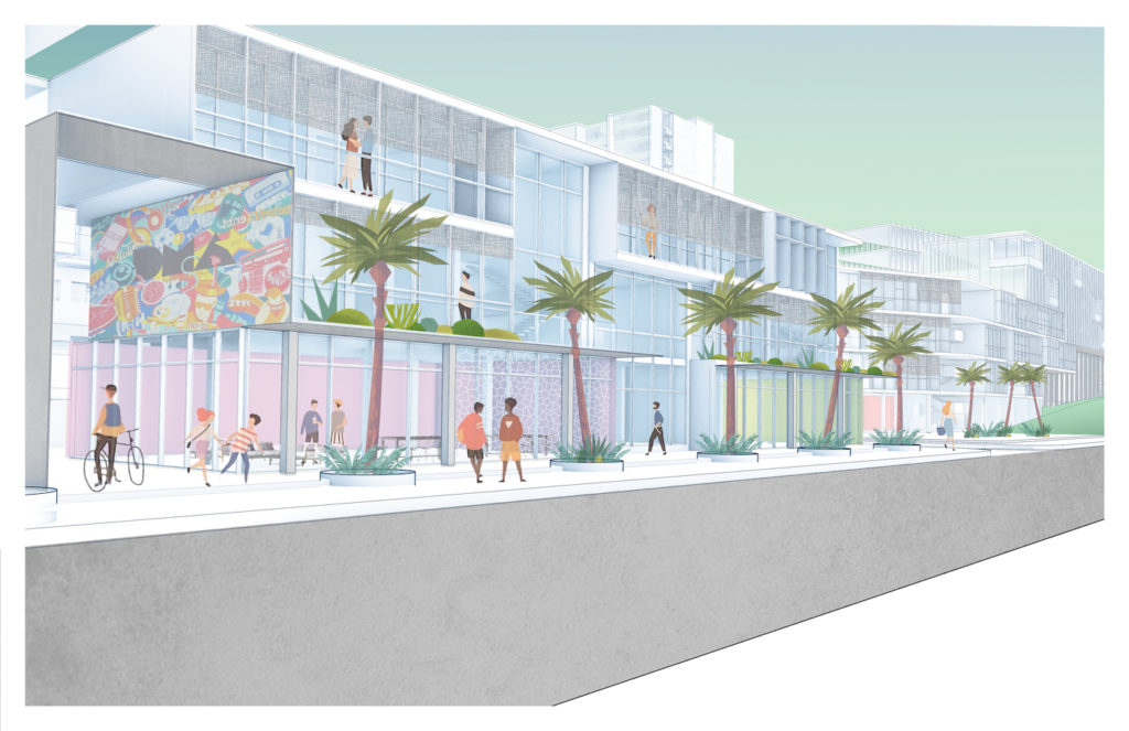
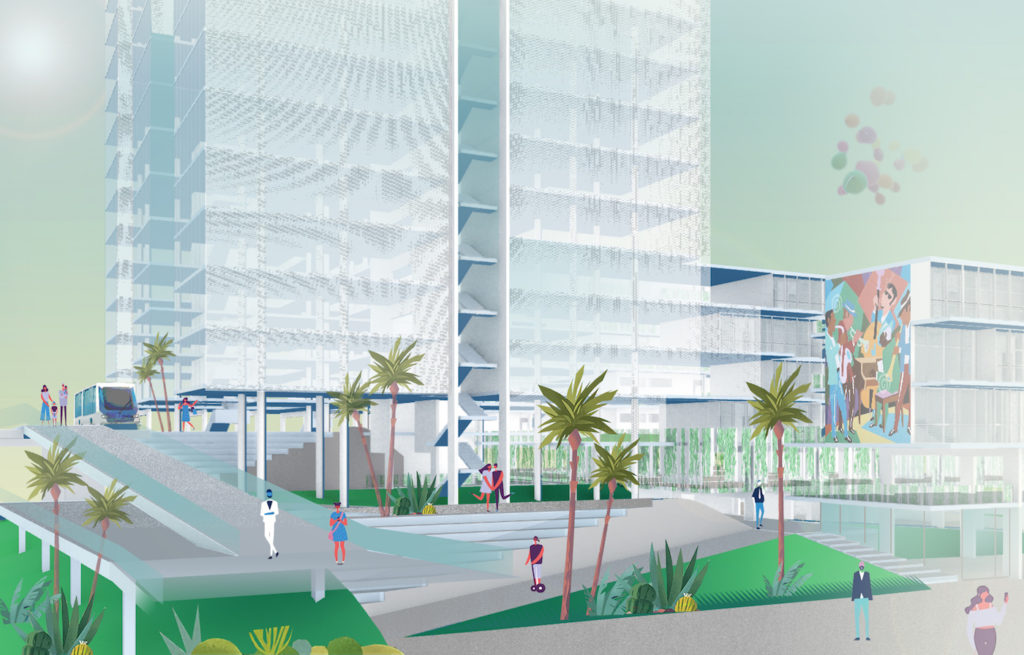
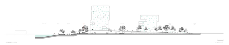
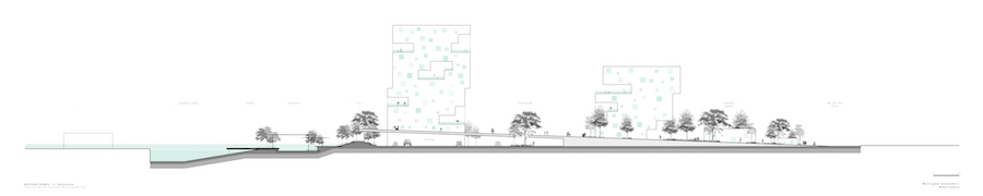
Miami Metro Strand
Miami Metro Strand
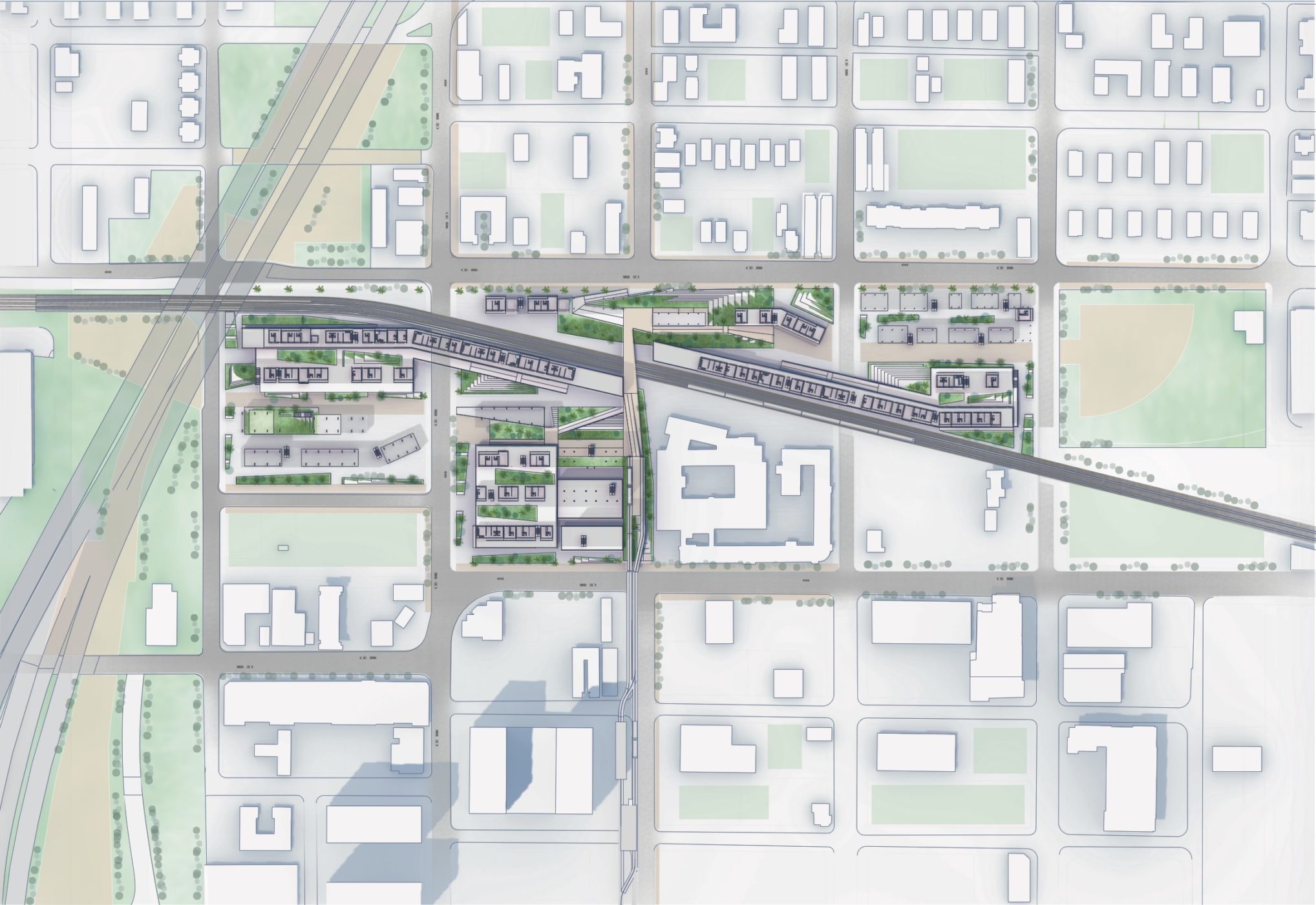
Sam Adkisson (MAUD ’19) and Hiroki Kawashima (MAUD ’19)
The border between Downtown Miami and Overtown negatively affects the later in a profound way and the overall prosperity of the city has failed to cross into Overtown. Activating this edge offers an opportunity to better link Overtown with the surrounding city. Giving better access to transit and a safe pedestrian path over the train tracks will create more activity in the area. Linking the two major parks in the area with a scenic and cool path through the site offers a variety of public spaces for all, a rarity in a city with few quality public spaces outside of the its beaches. Around all of these spaces are retail, restaurants and offices that support the local and up-and-coming business in smaller and more affordable space. The various gathering spaces give the Overtown community and the other future occupants places to congregate and socialize, which is difficult to do in Overtown today. Most importantly, contained within all of this is housing for all income levels, shifting away from the highly exclusive condos nearby, which displacing those that need proper housing the most. As Miami continues to urbanize, developments like the Metro Strand offer a better path forward for all residents.
Common Grounds: An Alternative Way of Living
Common Grounds: An Alternative Way of Living
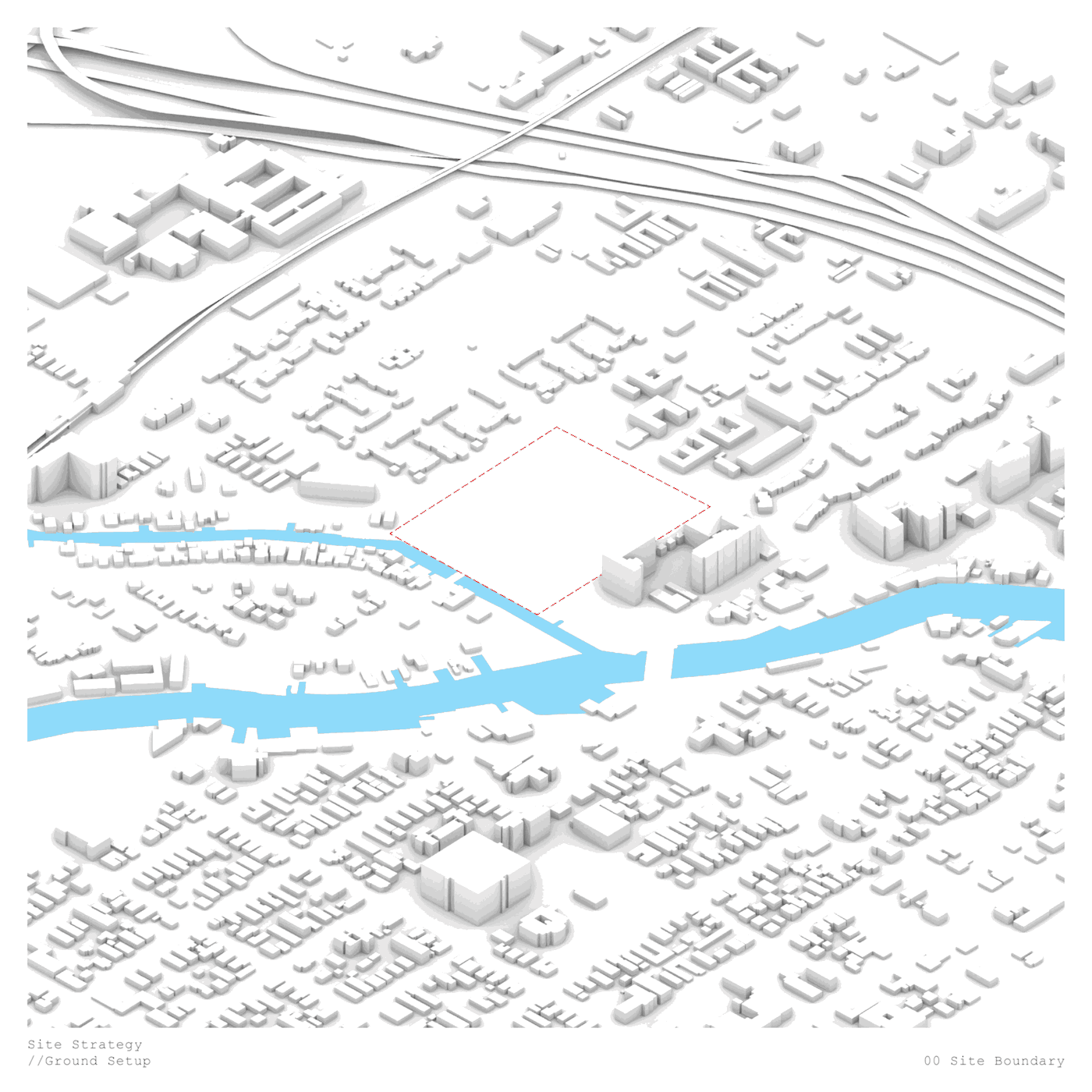
Parawee Wachirabuntoon (MLA I ’19) and Charles Smith (MLAUD ’19)
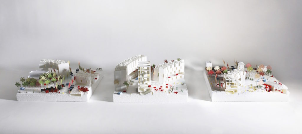
This project looks to create a collective and resilient living environment in a historically segregated and underserved community. Looking at this new development from a landscape perspective first we looked into the ideals of creating social interaction and resiliency through the proximity and adjacencies of the designed elements as they work together to foster a new way to live. We then analyzed land vacancy and land banking in the Overtown neighborhood as well as did a hydrological study to see how sea level rises, salt water intrusion, and king tides affect the neighborhood. From this analysis we found that many developers are buying large parcels of land in the area, this is due to the fact that Overtown is located on some of the highest and safest land in the city as well having a deeper water table that protects it from water that is pushed up the through the porous limestone as the sea water inundates the city more and more.
Our intervention occupies two Miami city blocks and connects to the Seybold canal that leads to the Miami River. The first design move was to excavate land closest to the Seybold canal to allow water to penetrate the site and create a wetland barrier as well as a water front park that is composed of multiple terraces that are flood tolerant and resistant. The housing in situated on a plinth of parking that slopes back to grade at the east edge of the site allowing for a smooth transition into the existing community. We utilized three different building typologies on site to allow for different domestic needs. These typologies all stem from the same desire to create a living composition that allows the residents to be more socially interactive while also feeling safe and apart of a community. This is done by placing building in such a way that smaller community clusters begin to form within the larger project, also no private balconies or courtyards are designed, it is all semi-public. The space between buildings would be able to be manipulated depending upon on how the resident wanted to use the space by adding potted plants and seating. This environment would also be interspersed with vernal pools to capture water running down the slope creating temporal spaces that change how they are occupied from a shaded seating area in dry conditions to a flood mitigation system in wet conditions. Overall the site has in all its elements the ideas of resiliency, communal life, and the public realm. This project responds to the multiple lifestyles that are encountered on a day-to-day basis.
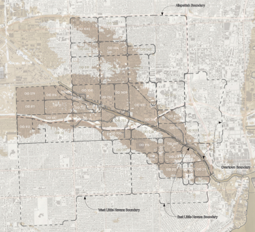
Climate Dense[city]: Building TOD on Higher Ground in Allapattah
Climate Dense[city]: Building TOD on Higher Ground in Allapattah
Kenner Carmody (MDes ’19, Energy & Environments)
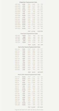
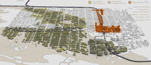
This research aims to visualize the required future housing stock necessary to accommodate displaced populations in Miami’s Allapattah neighborhood which will be affected by sea level rise and tidal inundation by the year 2100 (NOAA Office for Coastal Management). Property data, topological maps and NOAA sea-level rise projections are used in order to propose greater density in the City of Miami due to lost surface area around the Miami River. This study evaluates the existing spatial capacity and density distribution under current zoning policy, Miami 21. This study reveals that the current zoning code, overlay districts, and Neighborhood Development Zones (NDZ’s) within the population catchment area of Allapattah are maladaptive and should be completely reconsidered. Sited along Miami’s legacy metro system, a densification proposition in East Allapattah tests the hypothesis that a densified urban zone along underutilized existing transit infrastructure can accommodate new (and equitable) densities in Allapattah where housing, employment and amenities can cluster.
Across Racial and Infrastructural Boundaries: Integrated Park in Overtown
Across Racial and Infrastructural Boundaries: Integrated Park in Overtown
Chengzhang Zhang (MLA I ’19) and Qiaoqi Dai (MLA I ’19)
This project focuses on the Overtown neighborhood near downtown Miami. Overtown, also known as color town, once a vibrant black community, has witnessed high poverty rates, vacancy, and land speculation due to segregation by racial and infrastructural boundaries. This project proposes an integrated park, which embodies an urban strategy focusing on breaking boundaries and bringing investment for public in color town while avoiding gentrification. The project site locates on the joint of I-395 highway and the east edge of Overtown, as well as the historical color line and a freight railway. A new investment of a park on the site, proposed by Florida Department of Transportation as part of I-395 Highway extension, is unfortunately highly tourism oriented. Our proposal, on the other hand, reorients this investment to a continuous public park, which create physical stitch under the highway and over the rail between disparate parts of the community, fostering productive landscape and culture education as well as more than 600 affordable housing units as a revitalization of the community.
Food Sociability: Common Social Denominators
Food Sociability: Common Social Denominators
Evan Shieh (MAUD ’19) and Panharith Ean (MArch I ’20)
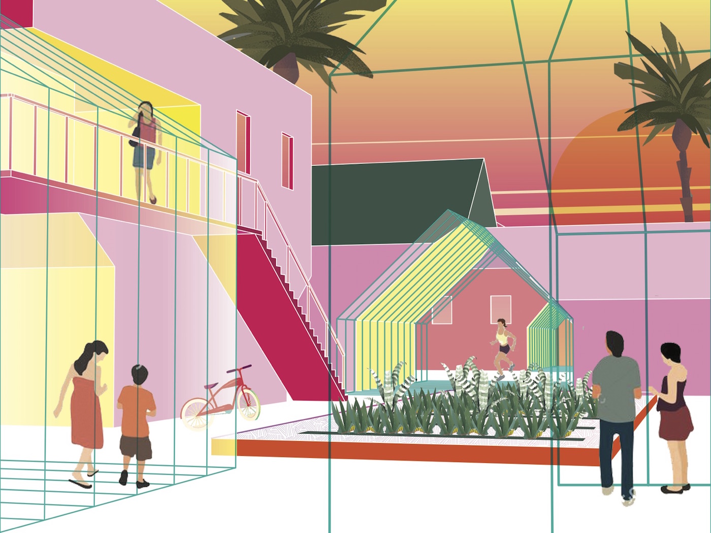
How do we design around the sociability of food and small-scale food production in the urban landscape as a catalyst for domesticity and communal living? This project is instigated by what might be termed the “common social denominator” of food and the sociability around eating together, gardening together, and living together, activities that bind us as humans. The project instrumentalizes the spatial sociability of food as the foundational building block to critique and intervene tactically in three typological sites, each representing a different ownership model.
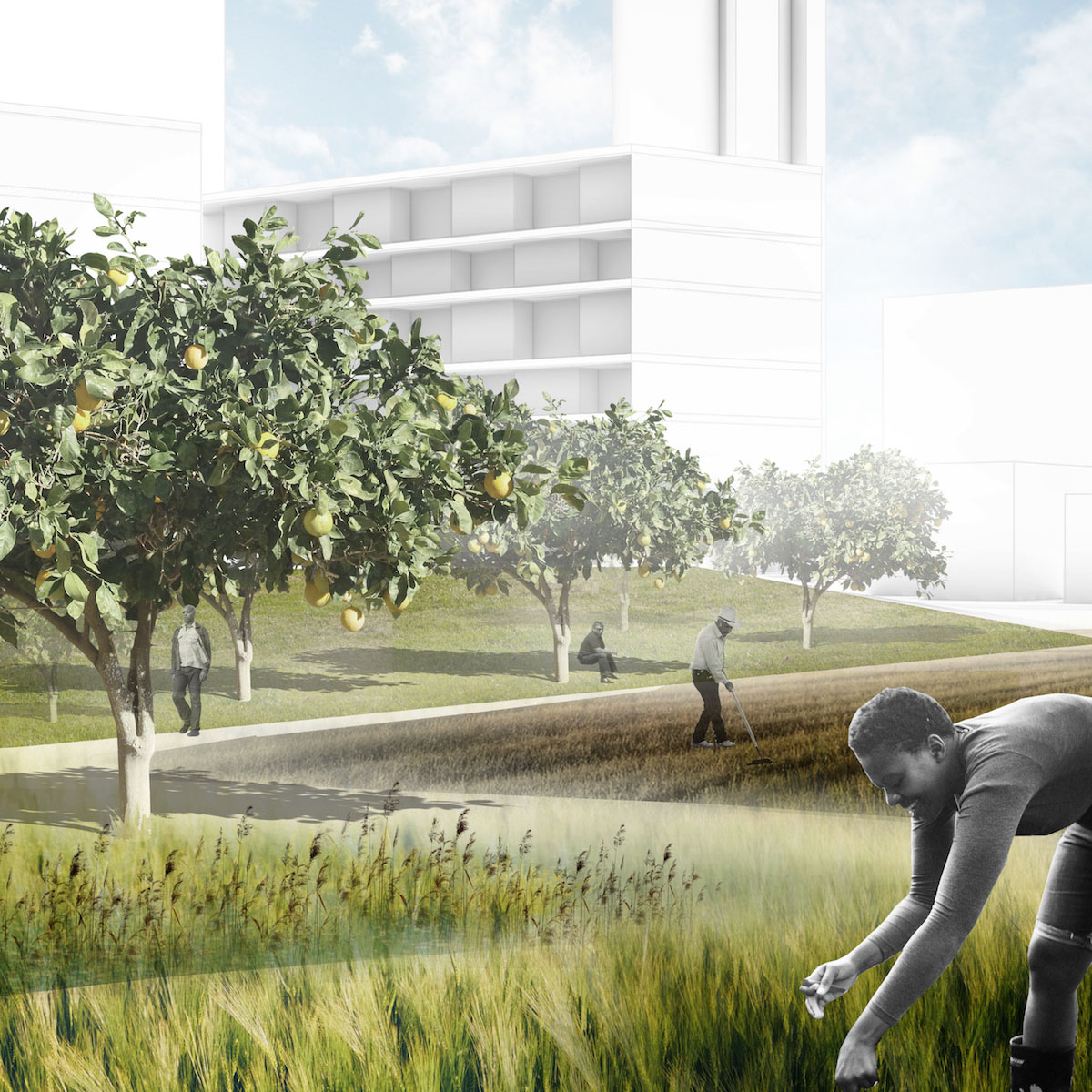
In the first site, the private single-family suburban block is co-opted with the introduction of Accessory Dwelling Units (ADU’s) that are tactically inserted into the backyards of existing single-family dwellings in order to increase density and provide additional rental income. In this model, previously underutilized side and back yards are activated by communal gardens and fruit trees while micro-openings in existing dwellings create sociability between neighbors.
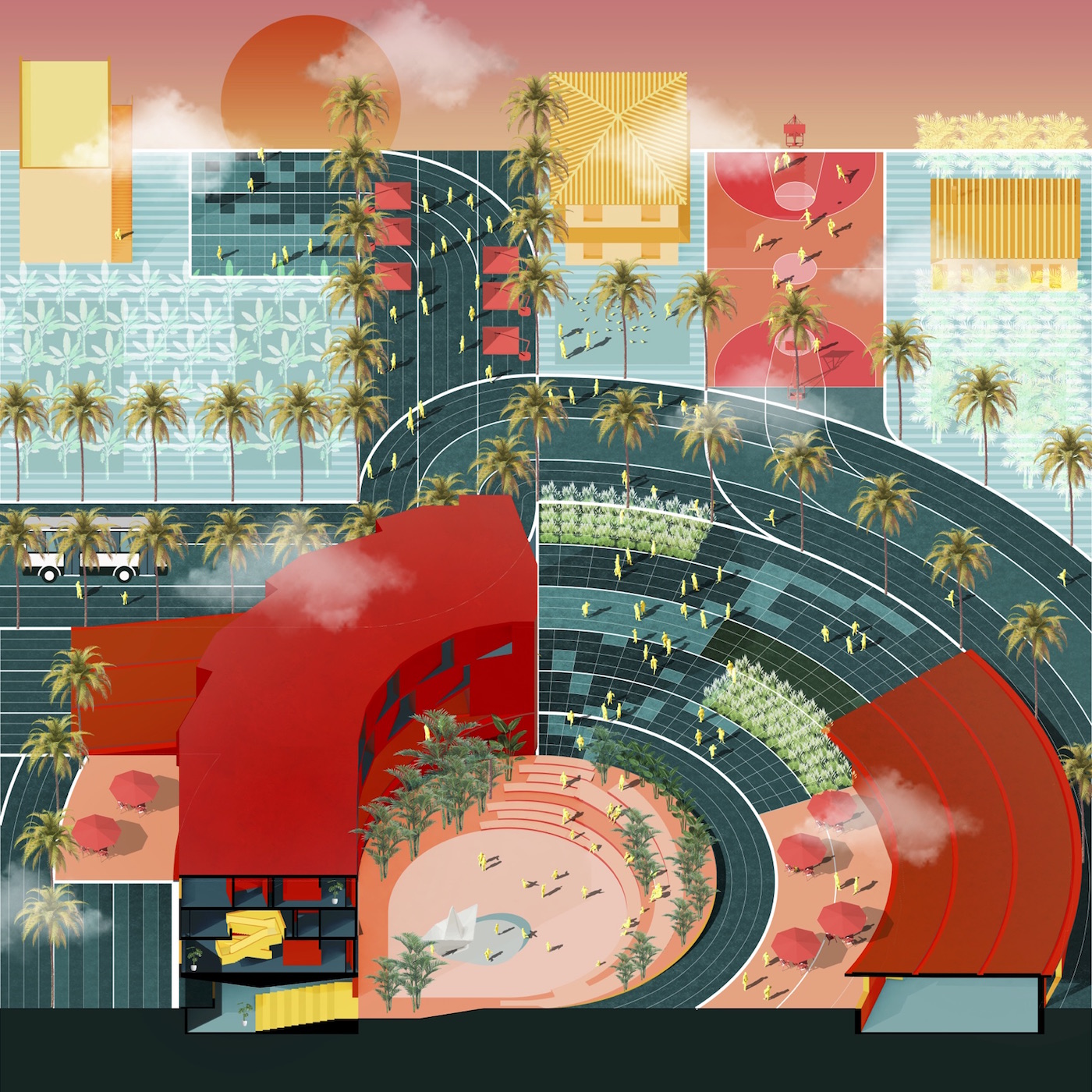
In the second site, a publicly-owned affordable housing mega-block is critiqued with a new block typology that inverts typically outward-facing porches towards the interior of the block. New interior-facing porches are reconstituted programmatically with communal kitchens and outdoor dining while porous block interiors are activated by greenhouses, community gardens, orchards, and recreational sports, anchored by guardian institutional community centers and corner restaurants.
Lastly, an existing commercial/cultural corridor in the district is reinforced by inserting extensions to existing restaurants and grocery stores, new retail and farmers markets on vacant lots, and even housing additions when density is needed.
In totality, the three sites represent an opportunity for tactical urbanism catalyzed by food sociability and food production, design strategies that spatialize and build upon the existing robust culture around food in the district of Overtown and the city of Miami at large.
The Ephemeral City: Productive Urbanism
The Ephemeral City: Productive Urbanism
Ting Liang (MLA I AP/MAUD ’19) and Zishen Wen (MLA I AP ’19)
Our project re-choreographs the physical fabric of Overtown, allowing for expressions of multiple identities through a series of new typological strategies of “Ground” and “Figure.” The project sets up an urbanistic framework which embeds the possibilities for changing, providing numerous ephemeral moments, creating an urban setting that is constantly engaging in the process of scripting and re-scripting itself while always open to next phases. The choreography of the places responds to the multiplicity of social impulses and social needs both from the existing and potential new communities. While there is specific timeframe, there is also no timeframe. The scale of interventions is initially subtle, but gradually implies systematic moves with more ambitious and radical changes, which overall inspires a projective future of new urban living that energetically engaged with social and environmental dynamics.
Climatic Crime
Climatic Crime

Cesar Castro (MUP/MDes ’19, Risk and Resilience)
The aim of this analysis will be to understand not only how crime may be impacted by climate change, but what specifically can planning and design contribute to a city’s effort to curb the impact of such environmental exposure in the short and long-term. Using the City of Miami as the primary site of investigation, this analysis will draw on long-standing research regarding the connection of crime and the built environment and the potential internal migration of people within the City of Miami to assess how concentrations of crime may shift overtime in low income areas. Central to such assessment will be a theoretical understanding that crime prevention, whether physical, legal, social, or otherwise, must include elements of community input and development in order for it to be truly comprehensive and ready to tackle the multidimensional challenges and opportunities of climate change, environment exposure, and crime for already vulnerable communities and in particular those that are least mobile.
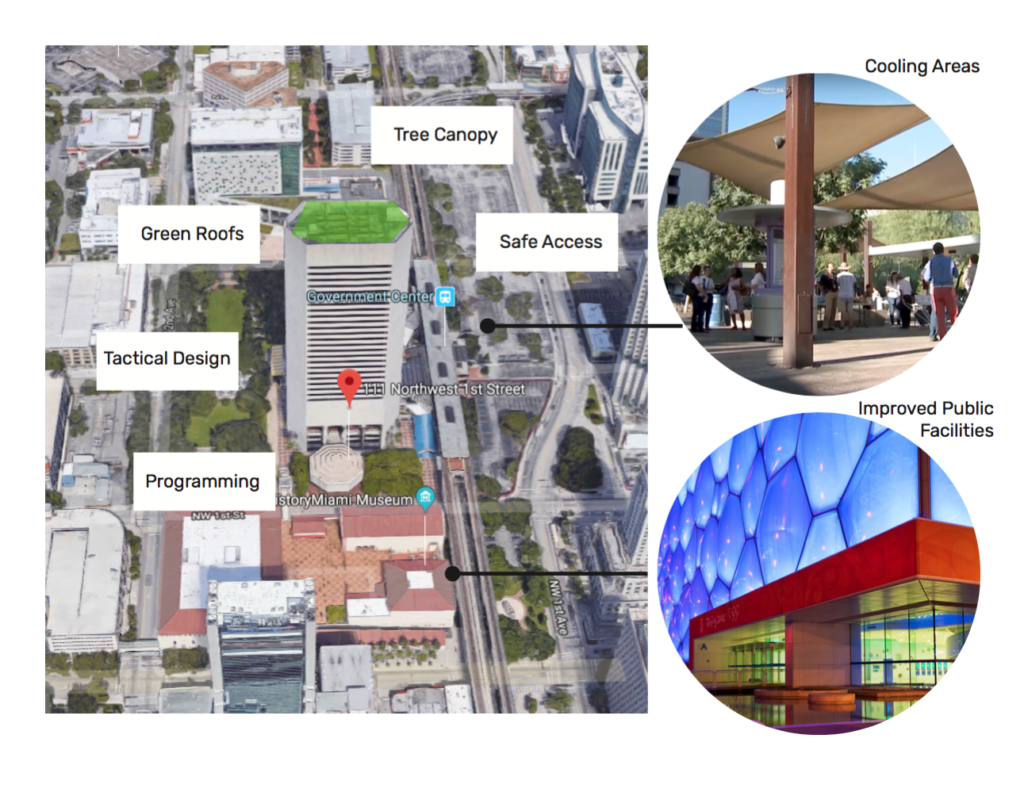
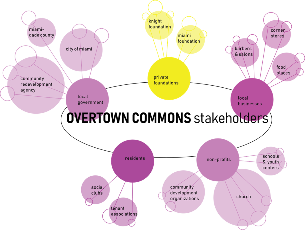
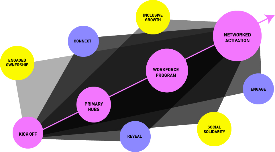
The Overtown Commons Toolkit
The Overtown Commons Toolkit
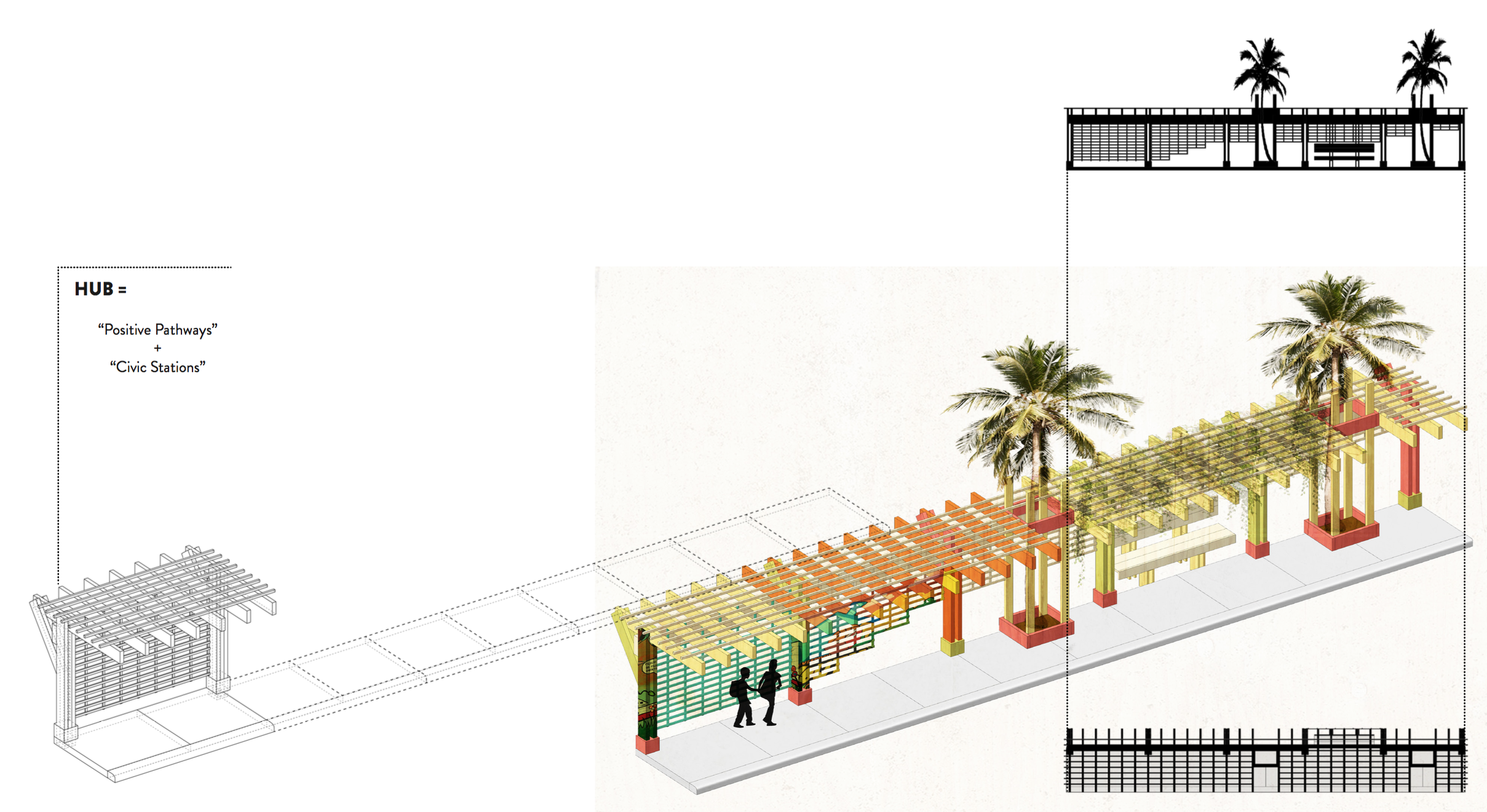
Elena Clarke (MDes ’20), Malika Leiper (MUP ’19), Chandra Rouse (MUP ’19)
The Overtown Commons Toolkit is a multi-pronged, multi-phased social and spatial strategy for the residents Overtown, Miami. It addresses the historic and contemporary effects of racism on the built environment and the spatial implications of imposed racialized urban policies in neighborhoods throughout the country. The design proposal works by presenting residents with a kit of parts (positive pathways + civic stations) that can be used to transform streetscapes and promote connectivity, while a workforce development program is built through youth civic engagement and job-training using a model of collective action. Informed by interviews with residents of Overtown, both past and present, young and old, our proposal responds to the following questions: How do we respect the spatial agency of residents and support the creation of a civic commons network as political power building?—and—What becomes possible when we see cities’ civic assets as a single network? Our aim is to provide a grounded and sustainable framework for positive change that fosters civic engagement, cultural sustainability, and inclusive economic development for the future of Overtown and its residents.