Resolution Grounds: Designing with the Fragmented Survey
Paris Bezanis (MArch I ’25)
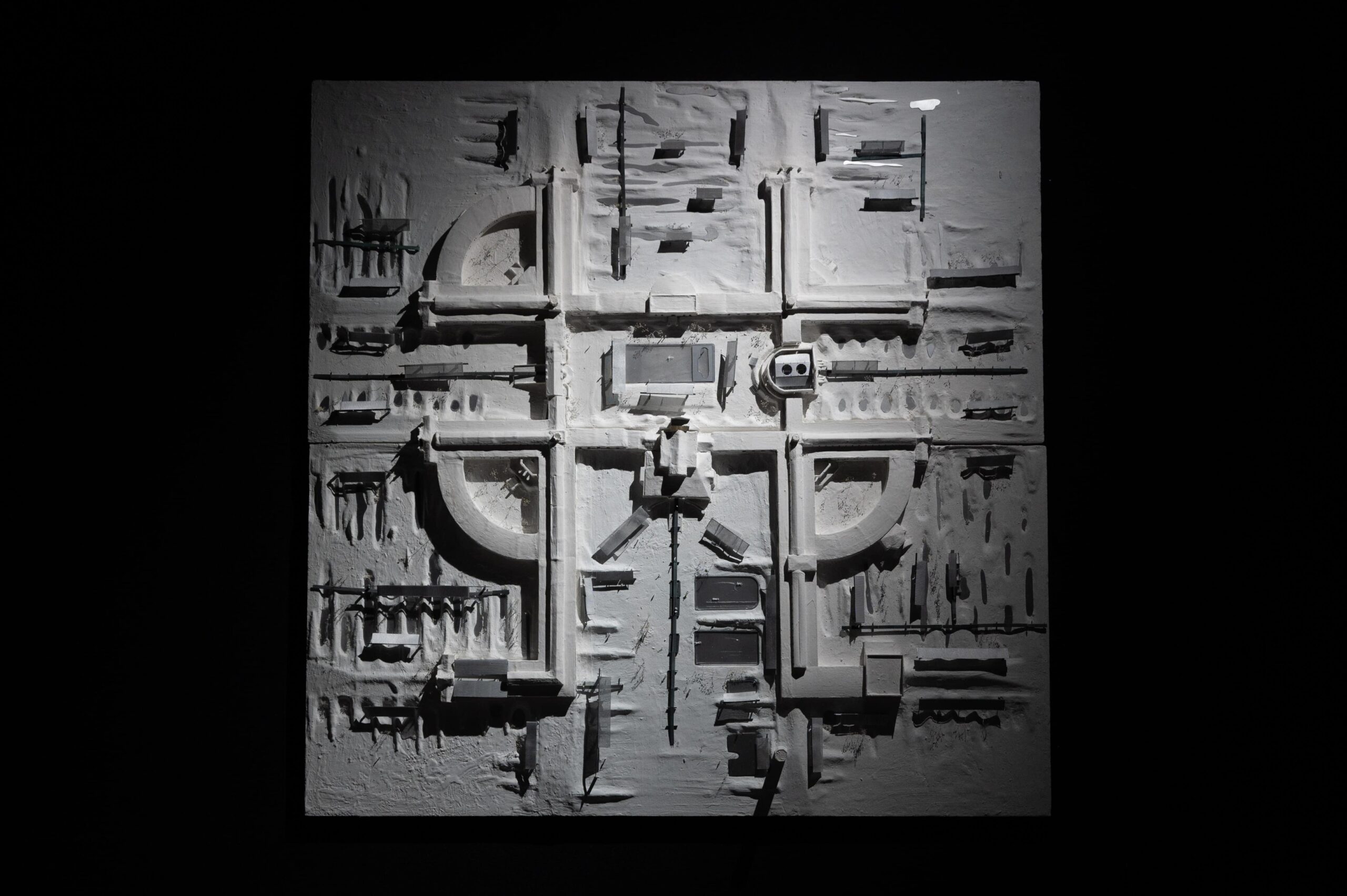
Resolution Grounds: Designing with the Fragmented Survey repositions the architectural survey as a site of epistemic and political contestation, challenging the premise that more data yields better design. At the Kuyalnik Estuary in southern Ukraine—a landscape shaped by ecological collapse, centuries of colonial therapeutic infrastructures, and wartime inaccessibility—the disciplinary pursuit of total visual capture is not only infeasible but ethically compromised. In its place, the thesis advances the fragmented survey: a methodology that constructs spatial records from open source but incomplete, low-resolution, and often extralegal visual material. Scraped drone footage, social media images, and archival fragments are not treated as raw inputs, but as situated digital artifacts, reconstructed through AI-assisted workflows that infer missing metadata and spatial relationships. Screenshots from embedded Google Maps flyovers are processed using monocular depth estimation tools like Marigold and Stable Diffusion, then passed through photogrammetry platforms such as RealityCapture or MeshRoom. Photogrammetry is operative here because it enables the translation of heterogeneous, often degraded visual material into spatial data—producing point clouds and meshes that can be acted on architecturally. The resulting outputs range from broken, sparse point clouds to partial meshes with high degrees of inference—surfaces warped by algorithmic guesswork and visual noise. These are supplemented with inpainting, deblurring, and neural alignment techniques, and further anchored by high-resolution Polycam scans captured on-site by local collaborators. The result is not a seamless model of a digital twin, but a digital sibling: an unstable, multiscalar, and composite reconstruction that foregrounds the technical and political conditions of its own assembly.
This composite and fragmented survey becomes a design instrument calibrated to its own inconsistencies. Each resolution informs a different scale of architectural intervention: coarse, inferred terrains underpin landscape-scale berms and sedimentary commons; intermediate scans guide the reuse of precast concrete elements from nearby Soviet housing stock; high-resolution fragments support detailed tectonic insertions within sanatorium ruins. By designing through interference rather than resolving it, the project reframes digital surveying not as a pursuit of mastery, but as a situated, ethical design practice. Here, resolution is not merely a technical attribute but a methodological stance—foregrounding approximation, scarcity, and collaboration as design prompts. In doing so, the project proposes a new role for computation in architecture: not as a tool for seamless visualization or predictive modeling, but as a critical mapping practice attuned to the politics of fragmented data, uneven visibility, and constrained access—where what can be
rendered is shaped by platform infrastructures, geopolitical opacity, and the contingencies of image circulation.
CREDITS
DDP Credits and Attributions
Paris Bezanis
Spring 2025
Credits and attributions are listed below for any work shown in the thesis project that is not exclusively my own.
Citations
- Bingxin Ke, Kevin Qu, Tianfu Wang, Nando Metzger, Shengyu Huang, Bo Li, Anton Obukhov, and Konrad Schindler. “Marigold: Affordable Adaptation of Diffusion-Based Image Generators for Image Analysis.” arXiv, May 14, 2025. https://arxiv.org/abs/2505.09358 . Code repository. PRS_ETH. https://github.com/prs-eth/marigold .
- Riku Murai, Eric Dexheimer, and Andrew J. Davison. “MASt3R-SLAM: Real-Time Dense SLAM with 3D Reconstruction Priors.” arXiv, submitted December 16, 2024; revised June 2, 2025. https://arxiv.org/abs/2412.12392 . Code repository. Imperial College London. https://github.com/rmurai0610/MASt3R-SLAM .
- Carousel image 21, bottom. Pierre-Yves Brunaud, photograph of paysarchitectures project in Geneva, 2017. Used as the base for a digital collage by the author.
Labor
Plastering model: Olivia Champ, Maria Ferrari, Hannah Kim
Planting and boardwalk assembly: Griffin Snyder, Emily Hayes, Aneesh Devi, Becca Schalip
Interiors Visualization Assistance: Denis Sola