The Public Realm Comes First: Landscape as a Catalyst for Urban Form
In his spring 2026 studio, Tom Balsley challenged students to rethink public space as the framework for urban growth.
“There’s an old saying that a camel is a horse designed by a committee,” Thomas Balsley says. “People often take that as proof that collaboration leads to compromised design. But I’ve found that when you take the time to listen, build trust, and show people that you’ve heard what matters to them, collaboration can produce stronger outcomes.”
Balsley, a landscape architect and urban designer for nearly six decades, has built a practice around that conviction. Working in the public realm, he sees design as a process of listening, dialogue, and translation—one that transforms communities’ aspirations into spaces that feel distinctive, place specific, and embraced by the people they serve. That philosophy formed the foundation of “Catalyst Landscapes/Urban Form,” a Harvard Graduate School of Design (GSD) studio Balsley taught in spring 2026, where students explored how designers can synthesize the perspectives of constituencies, collaborators, and diverse disciplines into a coherent urban vision.
From Practice to Pedagogy
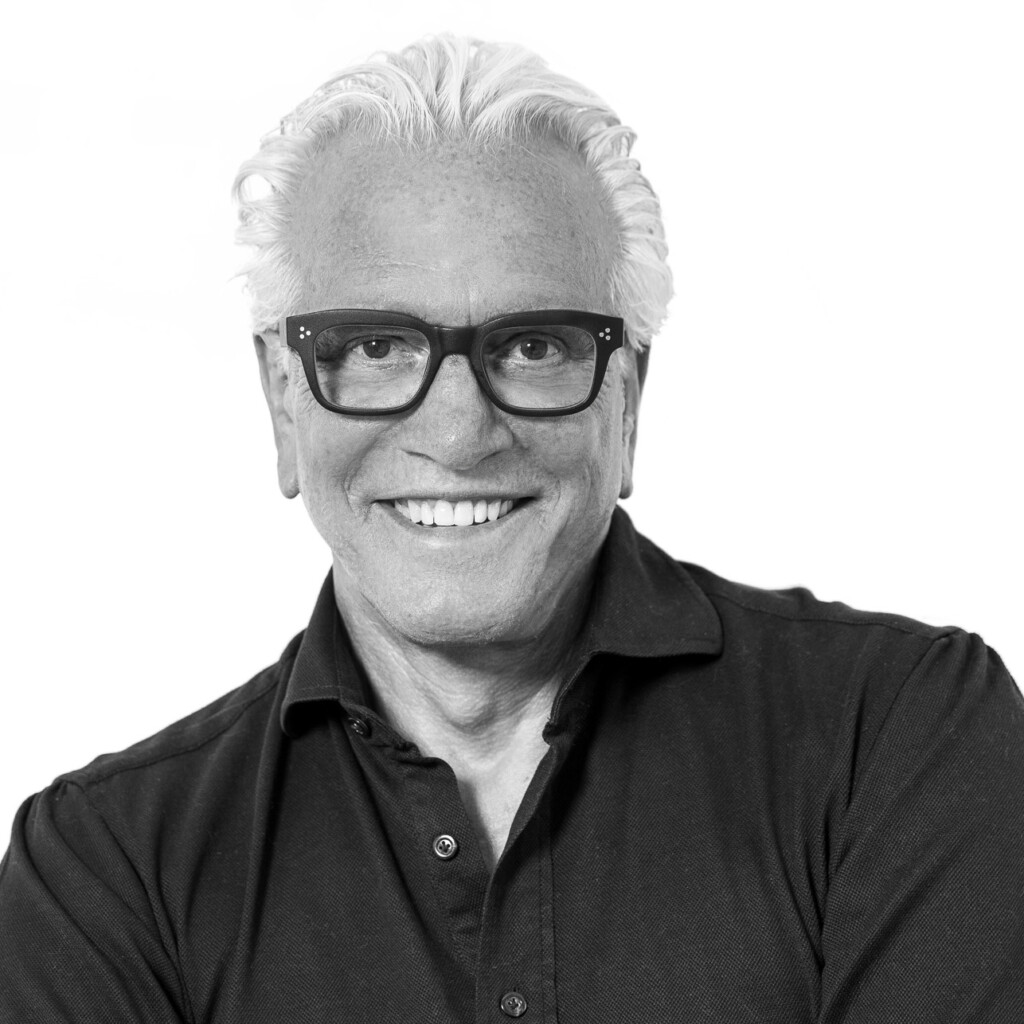
While teaching has become an important extension of his work, Balsley—a design critic in landscape architecture at the GSD—is first and foremost a practitioner. Through his eponymous firm and, more recently, as a principal at SWA/Balsley, he has worked at the intersection of landscape and urbanism, creating public plazas, parks, and waterfronts around the world. Yet the densest concentration of his work appears in New York City, where he has shaped more than 100 public projects—a number that continues to grow.
Balsley taught his first studio at the GSD in the early 2000s. In the years following, he took part in reviews at the school, including for a studio taught by Charles Waldheim in spring 2012. Named “The Horizontal Hudson,” this course focused on the post-industrial transformation of New Jersey’s Manhattan-facing waterfront. At that point, Balsley’s firm had been deeply engaged with the redesign of Riverside Park South Waterfront, a 24-acre multiphase project stretching along Manhattan’s West Side.
More than a decade later, Balsley returned to the GSD to lead a studio centered on a site in Rotterdam, the Netherlands, adjacent to Nelson Mandela Park, then under design by his firm. The studio was developed with Jerold Kayden, founding director of the Master in Real Estate (MRE) program and Frank Backus Williams Professor of Urban Planning and Design, and Gary Hilderbrand, then chair of the Department of Landscape Architecture and Peter Louis Hornbeck Professor in Practice of Landscape Architecture. Titled “Catalyst Landscapes/Urban Form,” the spring 2025 course brought together students in landscape architecture, urban design, and real estate. As one of three Development Projects offered through the MRE program, the studio placed real estate students in the role of developer alongside design students. The format simulated the realities of practice, requiring multidisciplinary teams to balance financial, market, regulatory, environmental, social, and design considerations while creating a proposal for development.
In the Rotterdam studio, working across disciplines encouraged students to engage perspectives beyond their own areas of expertise. By the end of the semester, many had developed a deeper appreciation for how design, development, and public interests can work in concert. “It was tremendous,” Balsley recalls. “At the final review, every student gave me a handwritten note about what mattered to them most about the experience. I was struck by how little of it concerned design itself. Most reflected on the connections they were able to make between my various shared experiences in the public/private realm and their studio challenges.”
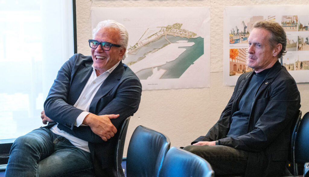
Building on the studio’s success, Hilderbrand invited Balsley to lead another iteration of “Catalyst Landscapes/Urban Form.” For Hilderbrand, the decision reflected both Balsley’s professional accomplishments and his impact on the students. “Tom is a prolific and deeply committed designer of public spaces,” says Hilderbrand. “He has had a singularly large impact on the public realm of New York City—and in cities around the globe.” Just as important, Hilderbrand notes, students across disciplines respond to Balsley’s collaborative style. “Students love to learn Tom’s approach to design and his generous way of working. He’s an urban design magnet, and that’s what we need.”
The spring 2026 studio expanded on that collaborative model. This time, urban planning students joined their peers in urban design, architecture, and landscape architecture. “That meant I had four different disciplines that needed to learn how to work together, speak the same language, find common ground, and develop mutual respect,” states Balsley. He selected a site in New York City, and the studio was underway.
A Site Shaped by Change
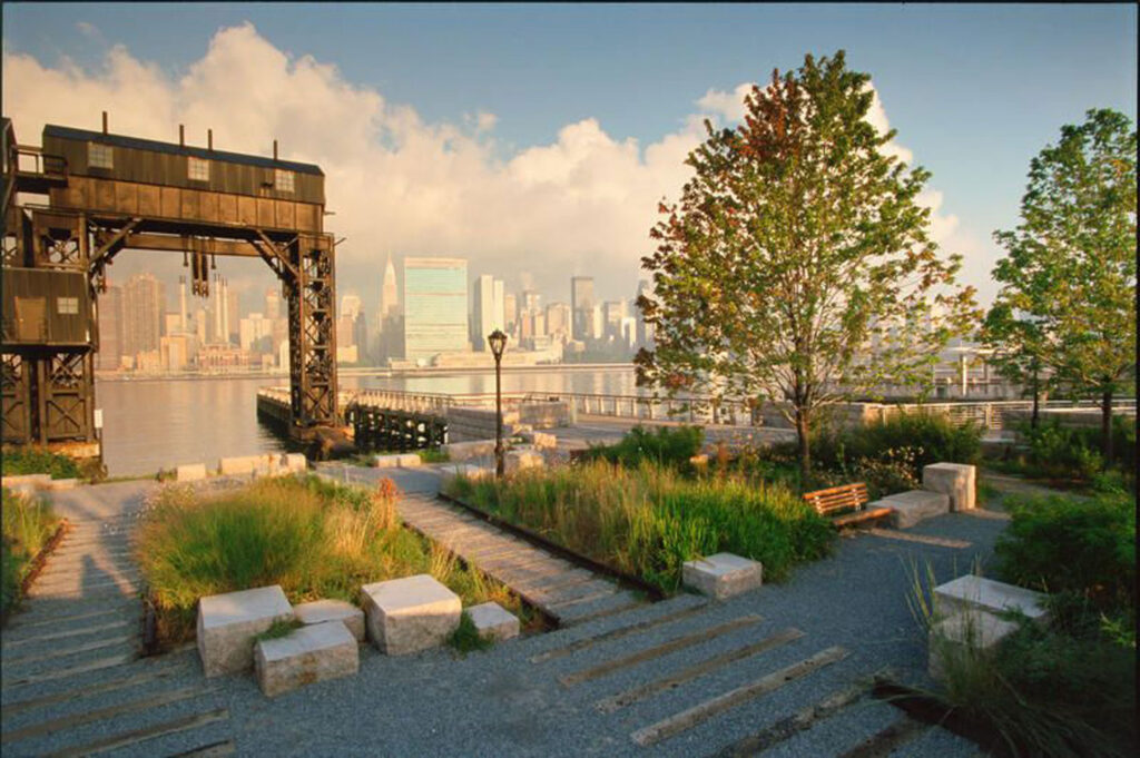
Balsley’s relationship with this site dates to 1993, when his firm developed a masterplan for the Long Island City waterfront, then primarily an industrial stretch of shoreline directly across the East River from the United Nations. Over the following decades, he witnessed the area’s dramatic transformation as new development and award-winning public spaces—including the Balsley-designed Hunter’s Point South Park and Gantry Plaza State Park—helped turn Long Island City into one of the fastest-growing communities in the country.
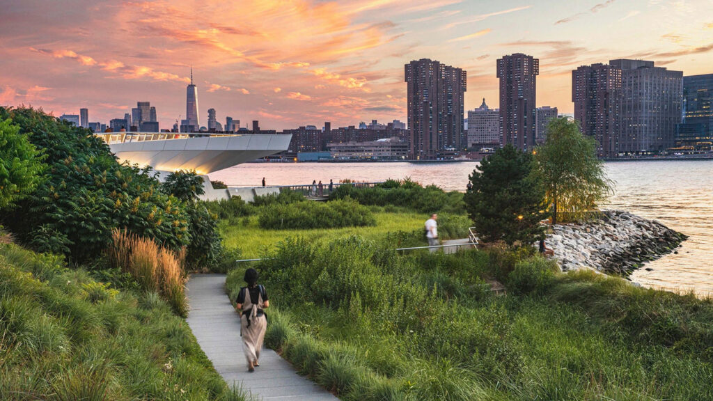
What had once been a landscape of one- and two-story industrial buildings became an increasingly dense urban district. Yet a stretch of waterfront extending from Gantry Park to the Queensboro Bridge remained largely untouched. Fragmented ownership and industrial zoning—despite no longer reflecting the area’s changing character—had stalled development.
For Balsley, this site was compelling both professionally and pedagogically. It occupied a contested place in Long Island City’s recent history: Amazon selected it for its proposed second headquarters, but community resistance ultimately halted the project and spurred a new neighborhood planning effort. As opposed to traditional top-down planning methods, community representatives, elected officials, city planners, and local stakeholders were all deeply involved in shaping the neighborhood plan that emerged. Yet even after that plan was approved, much of the area remained zoned for industrial use.
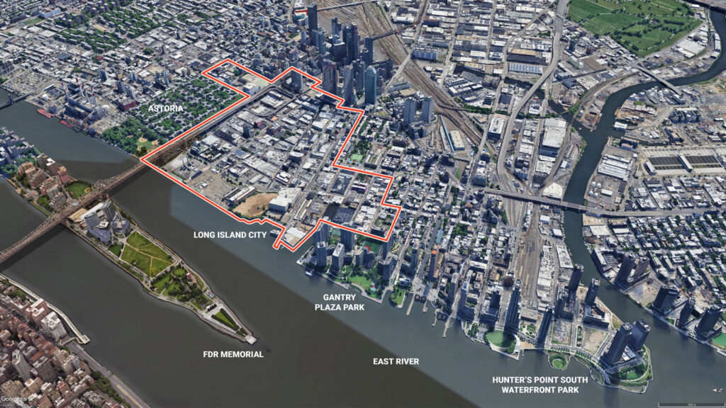
“The site covered roughly 40 blocks, but there was a central piece that remained zoned for industry and off-limits to housing, even as the city faced a severe housing shortage and many of the original industrial uses had long since disappeared,” explains Balsley.
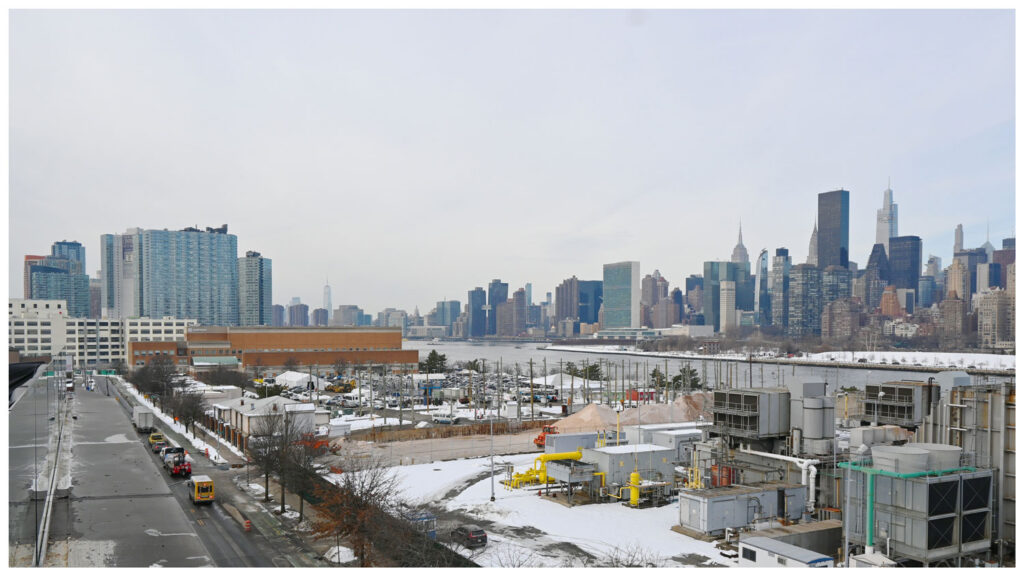
Then, in 2024, New York City adopted the City of Yes for Housing Opportunity initiative, a response to the city’s worsening housing shortage that opened the door to new residential and mixed-use development in areas long constrained by industrial zoning. For Balsley, the policy shift presented an opening.
“The site was essentially a giant donut hole at the center of Long Island City’s redevelopment,” he recalls. “When the door opened just a crack, I told the students, let’s kick it all the way open. We had an opportunity to imagine this area not as a leftover industrial enclave, but as a vibrant new community connected to everything growing around it—to turn the donut hole into a jelly donut.”
Landscape as Catalyst
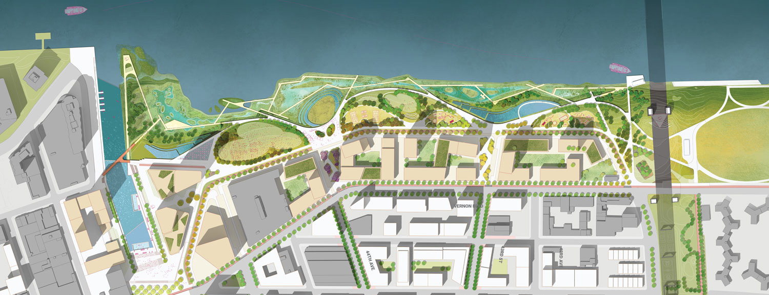
At the heart of “Catalyst Landscapes/Urban Form” was a simple but provocative question: What if public space came first? Rather than treating parks, waterfronts, and civic spaces as amenities added after development plans are in place, the studio challenged students to envision the public realm as the primary framework for urban growth. “That’s what we mean by a ‘catalyst landscape’,” Balsley explains. “Those open spaces and streetscapes become the building blocks of a resilient community as opposed to leftover spaces in the urban form.” In this model, public space serves as critical infrastructure that underpins the city’s social, cultural, environmental, and economic health.
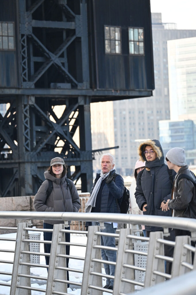
To explore that proposition, students were asked to think beyond individual buildings and land parcels and consider how the public realm might guide the evolution of a vibrant, mixed-use district. Working in multidisciplinary teams, they grappled with the interconnected forces that drive urban transformation, including housing, infrastructure, ecology, mobility, economic development, governance, and community priorities. The project required students to navigate competing interests, balance numerous objectives, and bridge disciplinary silos—challenges that closely mirror the realities of contemporary practice.
Balsley viewed this collaborative dynamic as one of the studio’s most important lessons. “Collaboration isn’t about equal participation in every phase of the work,” he notes. “It’s about recognizing expertise and allowing different people to lead at different moments.” As the studio moved from research and public engagement to planning, urban design, and landscape design, team members learned when to step forward, when to support, and how to work toward a coherent framework for the district’s future. Questions of policy, zoning, and development feasibility gave way to broader explorations of how landscape could shape urban form, requiring teams to adapt their roles as the work evolved.
Students approached the site from strikingly different angles. Some imagined an expanded waterfront; others a major central park; still others envisioned a constellation of smaller public spaces woven within the fabric of everyday life. Beneath these varied proposals was a shared conviction: Parks, plazas, waterfronts, and other public landscapes should serve as the organizing framework for future development rather than afterthoughts. While each team arrived at a distinct vision for Long Island City’s future, all confronted the same question: how public space can catalyze growth, resilience, and community-building at the district scale.
A Proposal to Catalyze Water, Ecology, and Public Life
Many Voices, One Vision
The work produced in “Catalyst Landscapes/Urban Form” challenged the familiar assumption that collaboration undermines design excellence. Instead, the studio showed how complexity can become a source of strength when different forms of expertise are aligned around a shared vision. Students learned that shaping the future of cities requires disciplinary knowledge as well as the ability to navigate competing interests, synthesize diverse perspectives, and translate them into coherent proposals for change.
In that sense, the studio’s most important lesson extended beyond Long Island City. The future of urban development will depend on professionals who can bridge the worlds of design, planning, ecology, and development while keeping the public realm at the center of decision-making. As Hilderbrand says, “Developers build our cities, and a well-designed and carefully stewarded, ecologically functioning public realm is what distinguishes good cities and neighborhoods.”
For Balsley, that lesson reinforces a principle that has guided his career: collaboration does not dilute design ambition—it strengthens it. When designers take the time to listen, foster trust, and reconcile competing priorities, public space becomes more than an amenity. It becomes the connective tissue that holds communities together and helps shape more resilient urban futures.