Can AI Help Cities Stop Housing Deterioration Before It’s Too Late?
A research team is using artificial intelligence and street-level imagery to identify neglected homes—and help cities intervene before they are lost.
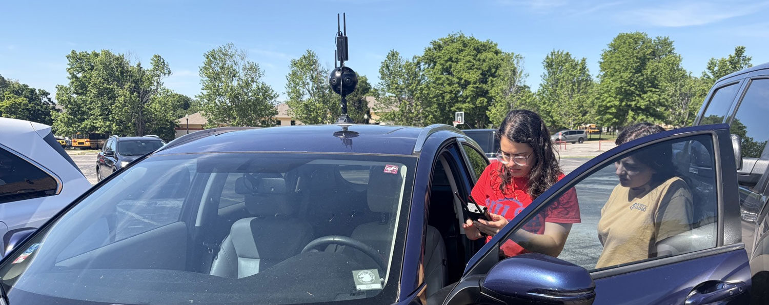
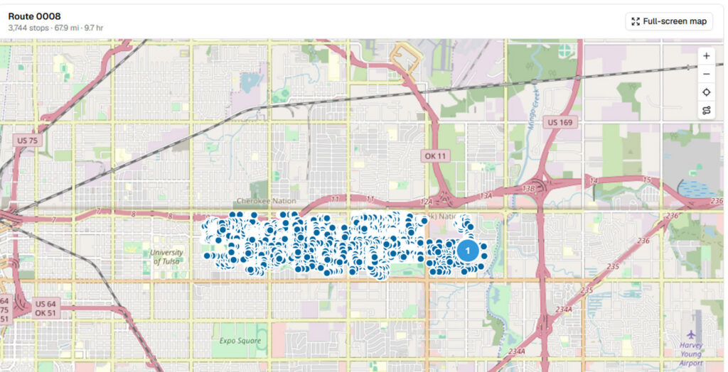
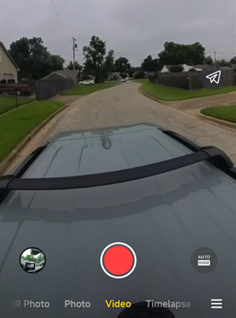
In the summer of 2026, as a punishing heat dome settled over Tulsa, Oklahoma, pairs of students—one driving, the other navigating—made their way through the city’s neighborhoods. A 360-degree camera mounted on the roof of their vehicle captured video of single-family houses, including those showing signs of neglect or abandonment, from which the researchers would later extract still images and match them to property records.
But the camera, purchased specifically for the project, could not withstand the extreme temperatures. Processing vast amounts of high-resolution data strained the camera, and a heat index that reached 120°F compounded the problem, causing it to repeatedly overheat. The students eventually bought a cheaper, less powerful camera, secured it to the car’s roof, and resumed their work.
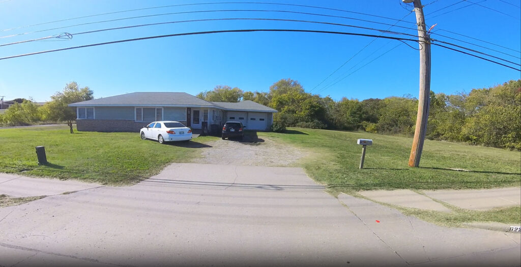
The students’ work traced back to an objective set nearly two years earlier by Tulsa’s newly elected mayor, Monroe Nichols, whose affordable housing initiatives included a goal of reducing housing blight by 60 percent by 2028. Meagan McCollum, then at the University of Tulsa and now associate professor of real estate development at Clemson University, reached out to contacts in the city’s housing office to offer help. “I asked, how many properties are we talking about? And they didn’t have an answer,” she recalls. Blight was a problem everyone could see but no one could quantify.
The term blight carries a troubling history: throughout the 20th century, urban renewal authorities invoked it to justify the demolition of entire neighborhoods, often displacing low-income residents and communities of color. Today, housing policy experts increasingly favor the more descriptive term VAD—vacant, abandoned, and dilapidated—to describe these conditions without the stigma associated with blight. For the Tulsa researchers, the goal is to identify signs of disrepair early enough to preserve homes rather than demolish them.
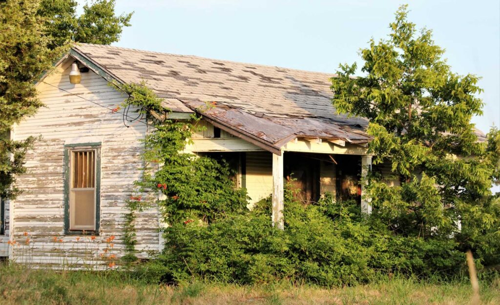
McCollum and Avis Devine, associate professor of real estate at the Harvard Graduate School of Design (GSD); Cayman Seagraves, formerly at the University of Tulsa and now assistant professor of real estate and finance at Florida Atlantic University; and Rachel Meltzer, senior research fellow at the Harvard University Joint Center for Housing Studies, are now leading a research project that combines artificial intelligence (AI), street-level videography, and municipal records to assess VAD conditions across Tulsa. Working with student researchers, city officials, and local housing organizations, they are developing a method that could help municipalities identify and monitor deteriorating properties more efficiently, reducing their reliance on labor-intensive inspections and neighbors’ non-emergency complaints.
Tulsa, like many American cities, faces a shortage of affordable housing even as some homes sit vacant or fall into disrepair. For Nichols, addressing VAD properties is part of a broader housing strategy—not just building more homes, but preserving existing ones.
Determining the extent of deterioration, however, is not straightforward. Cities typically rely on complaints, code violations, and individual inspections to identify problem properties, leaving many homes unexamined and concentrating resources on those that attract the most attention. Compounding the challenge, the work often falls to a small number of city employees, none of whom are dedicated specifically to VAD reduction.
“Municipalities often end up chasing the baby that cries the loudest,” says Devine, whose research examines real estate and sustainability. Complaint-driven systems can favor neighborhoods whose residents are more familiar with the reporting process and have the time to navigate it, rather than those where housing conditions are most severe. A comprehensive inventory could help cities direct limited resources more systematically—and more equitably.

Teaching AI to Recognize Deterioration
McCollum began exploring AI’s potential in 2025 through a pilot study at the University of Tulsa. Working with Jessica Shelton, director of research at Housing Forward, an Oklahoma housing policy organization, she obtained assessments of 4,500 properties previously inspected in person. Her five-person student team photographed those same buildings to determine whether AI could recognize the conditions identified by human inspectors.
The pilot suggested that the approach was feasible, but expanding it citywide would require additional expertise and funding. McCollum turned to Devine, a longtime research collaborator. Although McCollum focuses on single-family housing and Devine on commercial real estate and sustainability, they share an interest in the economic and social consequences of housing policy.
The decision to concentrate on single-family houses was both technical and practical. Because these houses tend to resemble one another more closely than multifamily buildings do, they offer a more consistent starting point for training AI to recognize deterioration. Multifamily properties, meanwhile, generally contain more housing units under a single investor-owner, making them a more efficient target for cities with limited enforcement resources—and leaving individual houses at greater risk of being overlooked.
To undertake the citywide study, the researchers secured a grant from the Bloomberg Center for Cities at Harvard University which funded equipment, travel, and computing costs. Through its Tulsa Undergraduate Research Challenge (TURC) program, the University of Tulsa involved undergraduates studying engineering, economics, computer science, and business, while its Junior Scholars program brought local high school students into the project.
During the summer of 2026, a dozen students—a mixture of TURC participants, Junior Scholars, and a graduate student—collected images across Tulsa, including in neighborhoods some had never visited despite having grown up in the city.
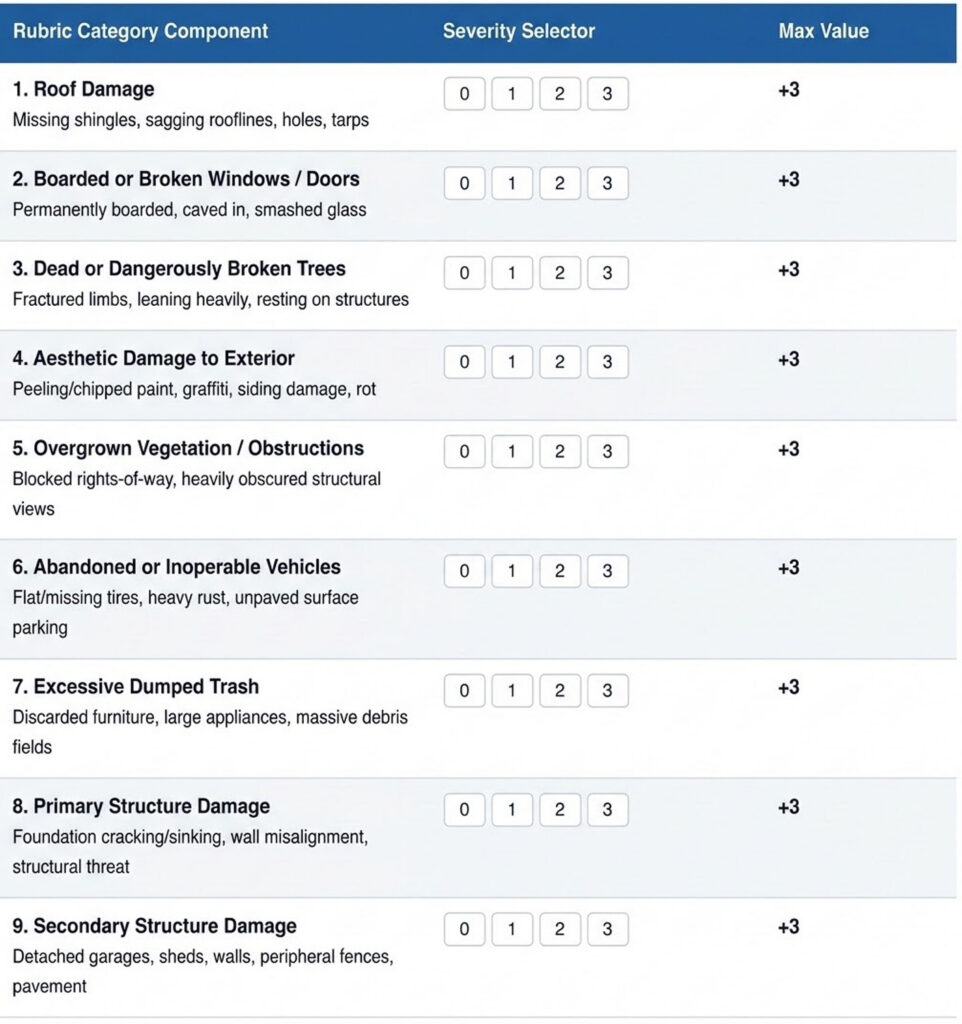
To assess property conditions, the students drew on existing research to develop a rubric with nine indicators of deterioration, ranging from relatively minor signs of neglect to serious structural problems. These included abandoned or inoperable vehicles parked on the property; cosmetic damage to a property’s exterior; boarded or broken windows and doors; dead or dangerously damaged trees; excessive trash; overgrown vegetation; and damage to roofs, primary structures, or secondary structures such as garages and sheds. While peeling paint or overgrown yards may be early warning signs, roof or structural damage may already require substantial repairs.
Using an app they created, students independently evaluated roughly 1 percent of Tulsa’s single-family houses, generating multiple assessments of each property to help train the AI—a task that consumed much of the summer.
The researchers also had to minimize the risk of AI mistaking architectural differences for neglect. Students cataloged Tulsa’s common housing styles and assembled examples of buildings with distinctive features, both with and without signs of deterioration. They wanted the model to recognize actual property conditions rather than flag unfamiliar-looking houses as problematic.
But still images alone cannot establish whether a property is vacant or abandoned. The researchers therefore plan to cross-reference their visual assessments with property records, information on code violations and property liens, and complaints to the city’s 311 service. Together, these sources could help them determine whether deteriorating properties are also vacant or abandoned and better understand the circumstances behind each property’s condition.
As McCollum explains, an absentee investor living out of state and an elderly resident on a fixed income might own houses that look equally deteriorated. The city might need to compel the investor to make repairs through code enforcement, while offering the resident financial assistance to do the same.
Beyond Demolition
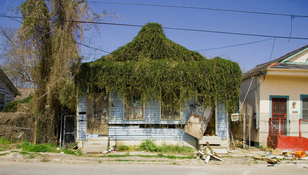
In researching how other cities address VAD properties, McCollum found that demolition was often the preferred response. Yet tearing down a house is expensive, and the vacant lot left behind can create problems of its own.
By identifying early warning signs, the researchers hope to help municipalities intervene before homes deteriorate beyond repair. Rather than demolishing a house after it has been abandoned, a city could preserve it while it is still habitable, structurally sound, and affordable.
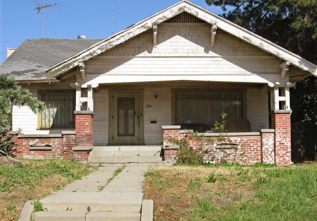
Photo: Downtowngal, CC BY-SA 3.0.

For Devine, preserving homes offers economic, social, and environmental benefits. It can reduce municipal expenditures, protect homes that may be affordable without public subsidies, and avoid some of the environmental impacts of demolition and new construction. As she notes, “The most carbon-efficient building is usually the one that’s already there.”
Making comprehensive property assessments practical for cities with limited budgets presents another challenge. Rather than produce a one-time survey, the Tulsa researchers hope to develop an affordable, repeatable method. Cameras mounted on vehicles that already travel residential streets, such as garbage trucks, could allow municipalities to update their housing inventories without organizing separate inspection campaigns.
The researchers are also exploring whether Google Street View could eventually provide an alternative to collecting their own visual data. For now, they need stills extracted from their video recordings to establish a reliable basis for comparison.
From Data to Decisions
As of November 2026, the team is still collecting visual data on all of Tulsa’s single-family houses, a process delayed by the summer’s extreme heat-driven equipment failures. They expect to finish by the end of the year, then develop the full AI model, combining visual assessments with property records and other information to evaluate VAD conditions citywide.
Meanwhile, they are conducting preliminary tests to understand how the AI processes and interprets smaller sets of images. With the full dataset expected to contain approximately 150,000 images, managing computing costs and evaluating the methodology’s reliability will be critical.
Once the model is operational, the researchers plan to work with Tulsa officials to determine how accurately it captures conditions on the ground and how useful the information might be for municipal housing decisions. Feedback from city officials will guide improvements in how the results are presented and how city staff might use them to prioritize interventions. This will help inform the team’s ongoing discussions with other cities about adapting the approach to their particular needs and circumstances.
The goal is not to replace housing inspectors or automate policy decisions. Instead, the researchers hope to give local governments a clearer picture of their housing stock so officials can intervene before deterioration becomes irreversible.