Plot Zero: Sensing the Landscape to Map the Dynamic Atmospheric Environment of the Urban Fabric
Introduction
Working at the nexus of the social, ecological, and technological in the built environment the project explores remote sensor technologies capable of continuous in-operation monitoring to measure atmospheric conditions at a hyper-local scale in the landscape. This approach seeks to make visible and reconstitute the urban landscape as a complex temporal and material manifold of differential space shifting across multiple scales in a constant state of flux. The research explores how a sensor network may be deployed to measure and describe airborne territories that might augment and challenge traditional concepts of site in which air is a matter of entanglement and interconnection.
Description
A great deal has been invested into significant advances in energy conservation and sustainability in building design, construction, and management. This also includes the time of their subsequent occupation and operation through the continual monitoring of building performance involving sensors and computational simulation to optimize energy efficiency and comfort. Sensor technology can change the way we understand and potentially radically transform the urban environments that are our cities. The technology augments the human perceptual field and enables a “dynamic, flexible and interactive mapping of reality, fueled by the staggering amount of data we produce” (RATI 2019) and ways of visualizing the data in real-time to inform better design and management of cities.
The research considers how this technology might enable ways to analyze and visualize the multiscalar, dynamic, and elusory matter of air and utilize it as a measure in, and of, the constructed landscape environment. How might we explore and speculate on our capacity to inform its continual becoming and its reciprocal effect as a part of an ecology upon which humans and more-than-humans might survive and prosper? How might this approach create different forms of valuing, assessing, and designing the urban landscape?
The physical composition of the urban fabric acts to absorb, produce, and trap heat, resulting in higher sustained temperatures 1-3 degrees (Celsius) warmer than neighboring rural areas. Heat generated in the city, including waste heat, is trapped along with airborne pollutants generated by vehicles, transport infrastructure, commercial enterprises, and industry. Subsequently, this condition adversely affects water and air quality and the health and well-being of its citizens. Energy demands simultaneously rise due to the prolonged and increased use of mechanical ventilation and air conditioning in response to the hotter temperatures that strain energy resources and further contribute to the production of global emissions.
The premise for the study is House Zero, a model house, facility, and laboratory. The building is a pre-1940’s typical suburban Cambridge “triple-decker” house retrofitted into an ultra-efficient, healthy, positive energy structure. The building contains “nearly five miles of wiring that capture 17 million data points per day. Some sensors are critical to the operation of the building: for example, controlling the system of windows and shades in response to inputs about temperature, rain, wind direction, and indoor CO2 levels and airflows.” (MALKAWI 2019). The house “promotes holistic change within the built environment, namely through the creation and continued improvement of sustainable, high-performance buildings and cities.” (MALKAWI 2019)
Method
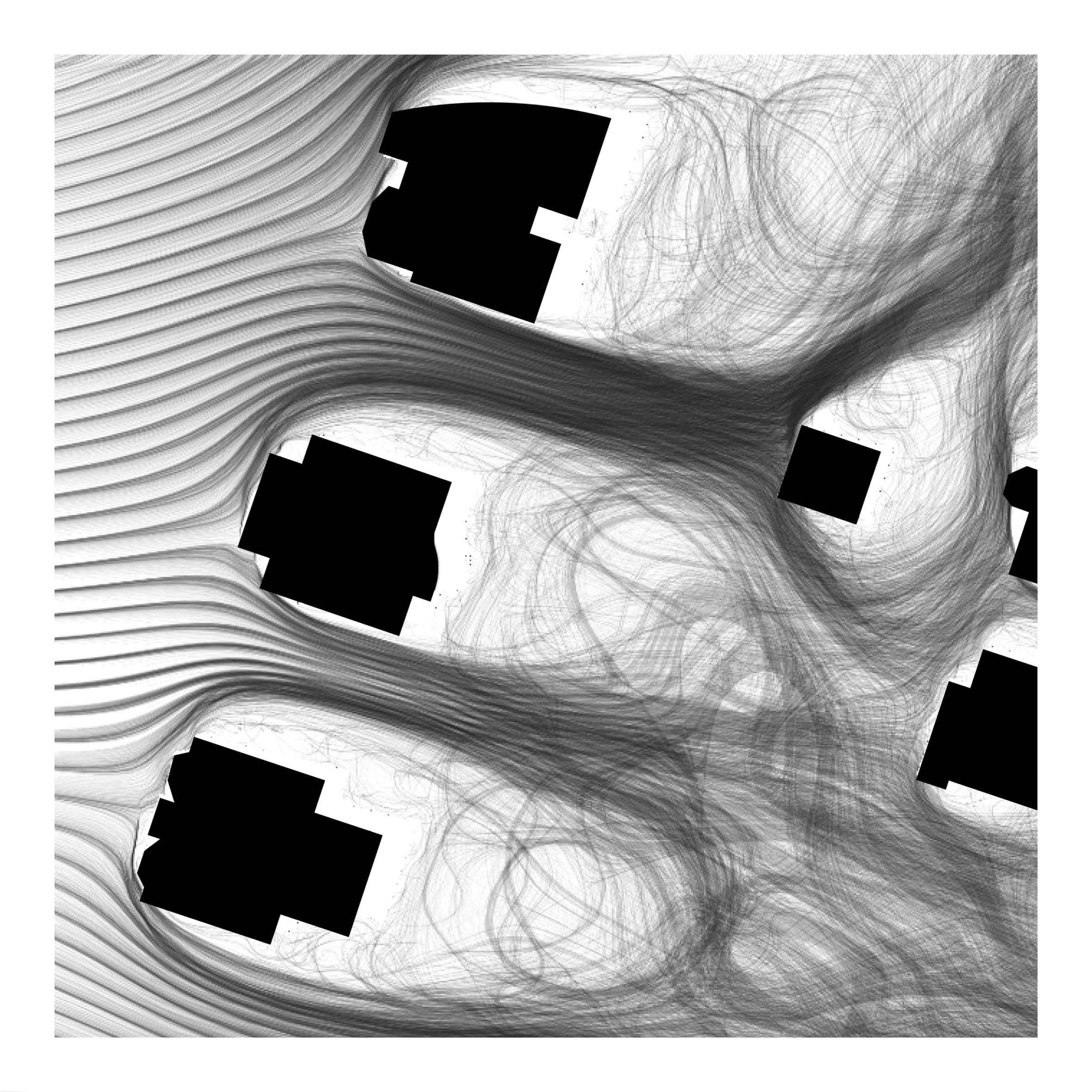
To support and augment the aspirations of House Zero the research seeks to expand the active sensor network outside the building envelope to the extent of the home’s plot boundary. The intention was to gather data specific to dynamic environmental parameters (e.g. solar and infrared radiation, air temperature, humidity, wind speed, carbon dioxide levels and significant air pollutants) that dynamically shape the network of outdoor urban spaces that envelop the building. This sought to understand the impact of the composition of outdoor spaces on the energy efficiency of the House Zero building operation. The enquiry asked how the landscape might support, or hinder, the efficient heating and cooling of the building, and how the building control system could be further augmented to act more carefully and efficiently with the external air qualities. This might include, for example, the utilization of optimal external conditions that may vary around the building at different times, and the identification of hazards that might alert and prevent venting the house from windows exposed to poor air quality that may arise, such as high levels of vehicle pollutants at peak traffic times on the street front.
The work also intended to make it possible to analyze and visualize the complexity of the atmospheric landscape system and identify its propensities in the form of its key operational characteristics. With this understanding, the research aspired to understand the atmospheric agency of the landscape to inform the design of spaces that contribute to the sustainability of the city and improve the health and well-being of its citizens. Given that the air in any one space and moment is a product of upstream conditions that shift and evolve through the outdoor urban landscape network in conjunction with the locally produced effects, and one that simultaneously informs downstream circumstances, the agency of designing an ‘air-scape’ is simultaneously local, territorial, and global.